Gartang Gali Trek: Route, Permit & Distance from Josimath
Priya Mehta
December 28, 2025
Explore Gartang Gali, the historic wooden bridge trek in Uttarakhand. Complete guide with history, how to reach, best time & trek difficulty.
Introduction: Uttarakhand's Historic Bridge Trek
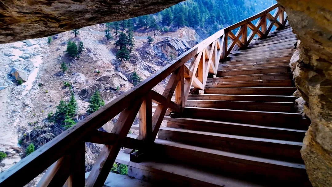
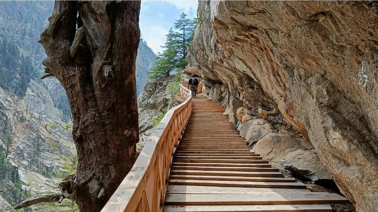
Gartang Gali stands as one of Uttarakhand's most fascinating historical attractions - a 150-year-old wooden bridge carved into a vertical cliff face in the Chamoli district. This remarkable engineering marvel, located near Joshimath, was once part of a crucial trade route connecting India to Tibet. Abandoned after the 1962 Sino-Indian war, the bridge was restored and reopened to tourists in 2021, offering adventure seekers a chance to walk along this narrow wooden path suspended dramatically above the Dhauliganga River.
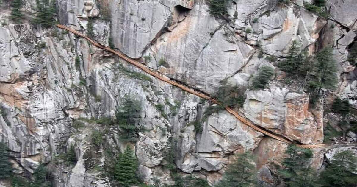
The bridge stretches approximately 136 meters along a near-vertical cliff face, hanging 100+ meters above the river below. Walking across Gartang Gali is an exhilarating experience that combines history, adventure, and stunning natural beauty. The wooden planks creak beneath your feet as the wind whistles through the gorge, creating an atmosphere that transports visitors back to the era when traders and merchants regularly traversed this precarious path laden with wool, spices, and other goods.
History & Construction
Origins in the 1870s
Gartang Gali was constructed in the 1870s during the British colonial era in India. The bridge was part of a larger network of trade routes that connected the Indian subcontinent to Tibet across the Himalayas. This region of Uttarakhand, particularly the area around Joshimath and Niti Valley, has historically been an important corridor for trade between India and Tibet, with goods flowing in both directions for centuries.
The construction of Gartang Gali was a remarkable feat of engineering for its time. British engineers worked alongside local craftsmen who had generations of knowledge about building in difficult mountain terrain. The choice to build the bridge directly into the cliff face was both practical and necessary - the terrain offered no other viable route for the trade path to continue towards the higher mountain passes leading to Tibet.
Construction Techniques
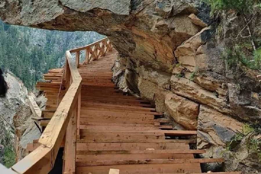
The bridge was constructed using traditional methods that have been used in the Himalayas for millennia. Local craftsmen carved small holes and ledges directly into the solid rock of the cliff face. Wooden beams, typically made from local deodar or other Himalayan cedar trees known for their strength and resistance to rot, were then anchored into these carved spaces.
These wooden beams formed the structural support for the bridge. Planks were laid across the beams to create the walking surface, and additional wooden railings were installed for safety (though these original railings were quite basic by modern standards). The entire structure was designed to be flexible enough to withstand the extreme weather conditions of the Himalayas - heavy snow in winter, strong winds year-round, and the freeze-thaw cycles that can damage more rigid structures.
Trade Route Significance
For nearly a century, Gartang Gali served as a crucial link in the India-Tibet trade network. Merchants and traders regularly crossed this bridge carrying goods such as wool from Tibet, spices from India, salt, tea, and various other commodities. The bridge was particularly busy during the summer months when mountain passes were open, allowing caravans to travel between the two regions.
The trade that flowed through Gartang Gali was economically important for communities on both sides of the border. Local villages in what is now Uttarakhand served as supply points and rest stops for traders, creating economic opportunities and cultural exchange between Indian and Tibetan communities. This cross-cultural interaction influenced the local architecture, food, language, and customs in ways that are still visible today.
Abandonment After 1962
The Sino-Indian War of 1962 changed everything for Gartang Gali and the entire trade route network it served. Following the conflict, the border between India and China was closed, and trade routes that had operated for centuries were abandoned. Gartang Gali, no longer needed for its original purpose, fell into disuse.
For nearly 60 years, the bridge was largely forgotten, exposed to the harsh Himalayan elements without maintenance. The wooden structure deteriorated significantly during this period. Some sections collapsed entirely, while others became dangerously unstable. The bridge became a local curiosity - spoken of in stories and legends but too dangerous to visit.
Restoration and Reopening
In the 2010s, as Uttarakhand began developing its adventure tourism potential, attention returned to Gartang Gali. The state government, recognizing the bridge's historical significance and tourism potential, undertook a major restoration project starting around 2019. The goal was to restore the bridge to a safe condition while preserving its historical character and construction methods.
Local craftsmen, many of whom were descendants of the original bridge builders, were employed for the restoration. They used traditional techniques and materials wherever possible, replacing rotted wooden beams with new ones anchored into the same holes carved into the cliff over a century earlier. The restoration also included adding modern safety features like stronger railings and reinforcement of support structures.
The restored Gartang Gali reopened to tourists in 2021, quickly becoming one of Uttarakhand's most popular adventure attractions. Today, visitors can safely walk across this historic bridge and experience a piece of Himalayan history while enjoying thrilling views and an adrenaline-inducing experience.
Location & Geography
District and Region
Gartang Gali is located in the Chamoli district of Uttarakhand, approximately 25 kilometers from the town of Joshimath. The bridge spans a cliff face above the Dhauliganga River in the Garhwal Himalayas region. This area is part of the larger Niti Valley region, which has historically been an important corridor between India and Tibet.
Altitude and Terrain
The bridge is situated at an altitude of approximately 2,800 meters (9,200 feet) above sea level. This high-altitude location means visitors should be aware of altitude considerations - the air is thinner and oxygen levels are lower than at sea level. Most healthy people adapt quickly, but it's something to be mindful of, especially if coming directly from lower elevations.
The terrain around Gartang Gali is dramatic and rugged. Near-vertical cliffs rise hundreds of meters on both sides of the Dhauliganga River gorge. The surrounding landscape is typical of the high Himalayas - steep slopes covered in alpine vegetation, rocky outcrops, and in the distance, snow-capped peaks. The gorge itself is a spectacular geological feature, carved by the Dhauliganga River over millions of years.
Nearby Village
The nearest permanent settlement to Gartang Gali is the small village of Jumma (also spelled Jumma), which serves as the base point for visiting the bridge. Jumma is approximately 7 kilometers from Gartang Gali and has basic facilities including a few small shops and simple homestays. The village offers a glimpse into traditional mountain life in Uttarakhand, with stone houses, terraced fields, and stunning views of the surrounding peaks.
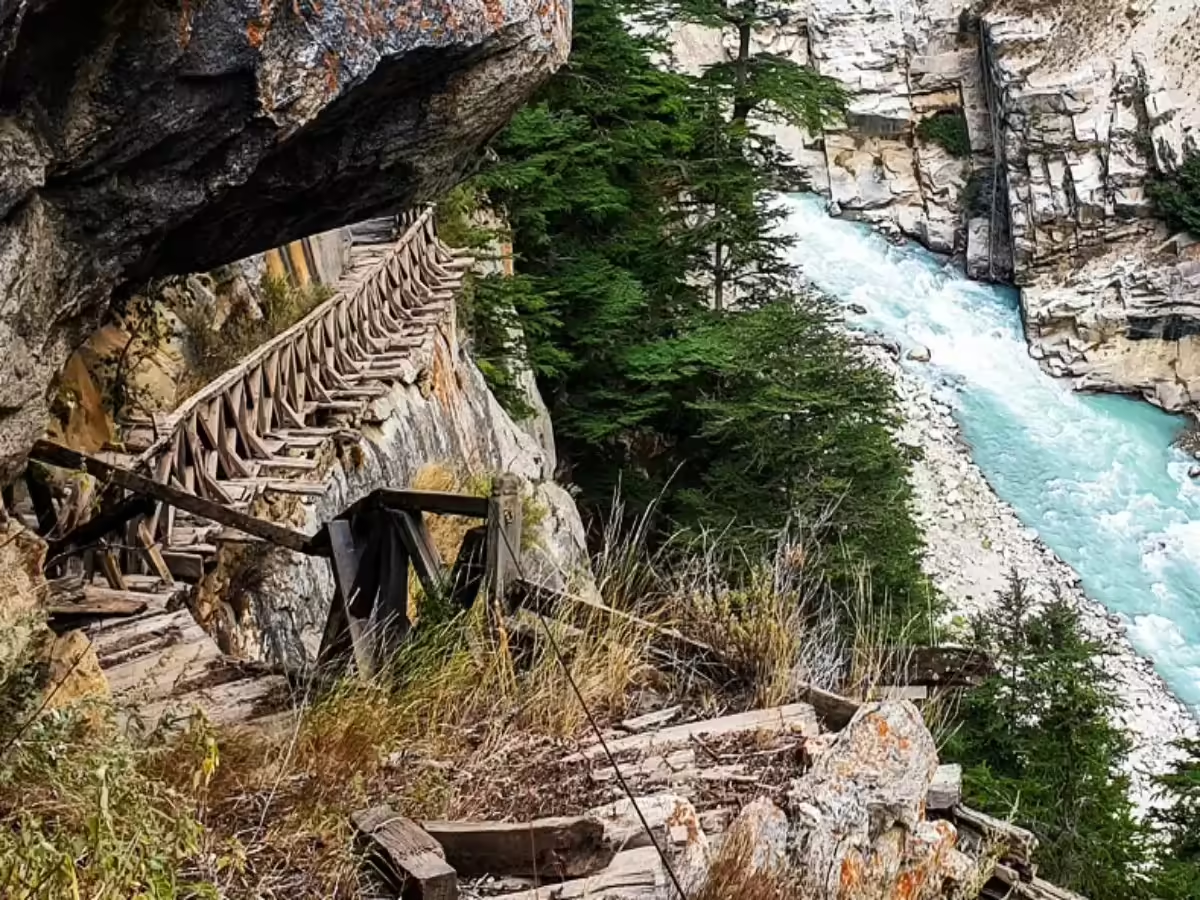
Dhauliganga River
Far below the bridge flows the Dhauliganga River, a tributary of the Alaknanda River, which is itself a major tributary of the Ganges. The Dhauliganga originates in Tibet and flows through a deep gorge in the Himalayas before joining the Alaknanda near Joshimath. The river is a spectacular sight from Gartang Gali - appearing as a thin ribbon of turquoise water far below in the gorge.
The Dhauliganga is known for its fast flow and cold water, fed by glacial melt from the high Himalayas. The river valley it has carved creates the dramatic geography that made Gartang Gali necessary in the first place - there was simply no other way to cross this section of the gorge other than building directly into the cliff face.
Surrounding Environment
The area around Gartang Gali is part of a larger Himalayan ecosystem that includes diverse flora and fauna adapted to high-altitude conditions. The vegetation is primarily alpine and sub-alpine, with coniferous forests dominating at slightly lower elevations. Birch, rhododendron, and juniper are common in the area. In spring and summer, alpine meadows burst with colorful wildflowers.
Wildlife in the region includes Himalayan species like the Himalayan black bear, leopards, and various species of deer and goats. Birdlife is abundant, with Himalayan monal (the state bird of Uttarakhand), Himalayan griffon, and various other species commonly sighted. The area around Gartang Gali offers opportunities for wildlife viewing, though sightings are never guaranteed due to the rugged terrain and elusive nature of mountain wildlife.
Trek Experience & Difficulty
Overall Difficulty Level
The trek to Gartang Gali is considered easy to moderate, making it accessible to most reasonably fit people. The walk from Jumma to the bridge covers approximately 7 kilometers round trip and typically takes 3-4 hours at a leisurely pace. The trail itself is not technically difficult - there's no scrambling or climbing involved. However, the bridge crossing itself can be mentally challenging for those with a fear of heights.
The trek can be broken down into three sections: the drive from Joshimath to Jumma (18 kilometers by road), the walk from Jumma parking to the bridge starting point (approximately 3.5 kilometers), and then the actual bridge crossing and exploration.
Trek Distance & Duration
Joshimath to Jumma: 18 kilometers by road, approximately 1 hour by car/taxi. The road is motorable but can be narrow and winding in sections.
Jumma to Gartang Gali: 3.5 kilometers each way on foot. This section typically takes 1-1.5 hours each way, depending on your pace and how often you stop for photos and rest breaks.
Time on Bridge: Allow 30-60 minutes to walk across the bridge, take photos, and explore the area. The bridge is 136 meters long, but you'll want to spend time enjoying the views and experiencing the unique atmosphere.
Total Time: Plan for 4-5 hours total, including travel from Joshimath, the trek, and time spent on the bridge.
Terrain Description
The trail from Jumma to Gartang Gali follows a mountain path that is generally well-defined. The first section from Jumma village passes through small agricultural fields and traditional houses. As you leave the village, the path enters more rugged terrain with rocky sections and some inclines.
The trail is not steep for most of its length, though there are some moderate ascents and descents. The path can be narrow in sections, with drop-offs on one side - though nothing compared to the exposure you'll experience on the bridge itself. The surface varies from packed earth to rocky sections, with some steps cut into the rock in steeper places.
The most challenging part of the trek for many people is the bridge crossing itself. The wooden planks have small gaps between them, allowing you to see the drop hundreds of meters below. While the bridge is completely safe following its restoration, the psychological effect of walking across a wooden bridge suspended on a cliff face can be intense.
Fitness Requirements
Basic fitness is sufficient for this trek. You don't need to be an athlete or experienced trekker, but you should be comfortable walking for several hours and climbing some hills. Regular aerobic exercise in the weeks before your visit will make the trek more enjoyable.
There's no technical climbing or mountaineering involved. The main challenges are the distance, some uphill sections, and the mental challenge of the bridge exposure. If you're reasonably active and healthy, you should be fine. However, if you have serious vertigo or a fear of heights, this might not be the trek for you.
Safety Features
Following the 2021 restoration, Gartang Gali has several safety features that weren't present in its original incarnation:
- Reinforced Structure: The wooden beams and planks are new and strong, well-anchored into the cliff face.
- Sturdy Railings: Modern railings run along both sides of the bridge, providing something to hold onto.
- Regular Maintenance: The bridge is inspected regularly, and any damaged planks or beams are replaced.
- Guides Available: Local guides can accompany visitors, providing both safety and information.
Despite these safety features, the bridge still feels exposed and thrilling - this is part of what makes the experience special. The restoration struck a balance between safety and preserving the adventurous, historical character of the bridge.
How to Reach from Joshimath
Joshimath as Base
Joshimath (also called Jyotirmath) serves as the main base for visiting Gartang Gali. This important town in Uttarakhand is well-connected by road to major cities in northern India. Joshimath itself is a popular destination, serving as a base for pilgrims visiting Badrinath Temple and trekkers heading to Valley of Flowers and Hemkund Sahib.
The town has numerous hotels, guesthouses, restaurants, and shops, making it a comfortable place to spend a night or two. Most visitors to Gartang Gali stay in Joshimath and make the trip to the bridge as a day excursion.
Joshimath to Jumma
From Joshimath to Jumma village is approximately 18 kilometers by road. The journey takes about 1 hour by car or taxi, depending on road conditions. The road is generally in decent condition but can be narrow and winding in typical mountain fashion.
Transportation options from Joshimath to Jumma include:
- Private Taxi: The most convenient option. Taxis can be hired in Joshimath for the round trip. Expect to pay approximately ₹2,000-3,000 for the day, including waiting time while you visit the bridge.
- Shared Jeep: A more budget-friendly option, though shared vehicles to Jumma may not run on a fixed schedule. You might need to wait for enough passengers to accumulate.
- Private Vehicle: If you're driving your own vehicle or have hired a car for your Uttarakhand trip, you can drive to Jumma. Parking is available near the trailhead.
Jumma to Gartang Gali
From Jumma village, the bridge is approximately 3.5 kilometers on foot. This is the only way to reach Gartang Gali - there's no road access to the bridge itself. The walk from Jumma takes you through beautiful mountain scenery and offers glimpses of the dramatic gorge that the bridge spans.
The trail is well-defined and easy to follow. In fair weather, you probably won't need a guide for this section, though hiring one is recommended if you want to learn about the history and culture of the area. Local guides from Jumma are available and can be arranged either in advance or on the spot.
From Other Locations
From Rishikesh/Haridwar: Most visitors to Joshimath come via Rishikesh, which is the nearest major city with good transport connections. Rishikesh to Joshimath is approximately 250 kilometers, taking 8-10 hours by road depending on traffic and road conditions. From Haridwar, it's slightly further at about 275 kilometers.
From Dehradun: The state capital is approximately 290 kilometers from Joshimath, taking about 9-11 hours by road.
From Delhi: Delhi to Joshimath is approximately 500 kilometers, taking 14-16 hours depending on traffic. Most travelers break this journey with an overnight stop in Rishikesh or Haridwar.
Best Route from Delhi
For those driving from Delhi, the recommended route is: Delhi → Rishikesh → Srinagar (Garhwal) → Rudraprayag → Chamoli → Joshimath → Jumma → Gartang Gali. This route passes through beautiful mountain scenery and several important pilgrimage towns. The roads are generally good, though expect winding mountain roads and some sections with traffic, especially during pilgrimage season (May-June).
Best Time to Visit
Summer (May - June)
Early summer (May-June) is an excellent time to visit Gartang Gali. The weather is generally pleasant during these months, with daytime temperatures ranging from 15-20°C at the bridge's altitude. The skies are usually clear, offering excellent visibility of the surrounding mountains and the gorge far below.
May is particularly good as it's before the main pilgrimage season to Badrinath, so you're less likely to encounter crowds on the trail or at the bridge. June sees more visitors as pilgrimage season picks up, but the weather remains excellent for outdoor activities.
During summer, the trail from Jumma to the bridge is dry and easy to walk. Wildflowers bloom in the alpine meadows, adding color to the landscape. Days are long, giving you plenty of time to complete the trek without rushing.
Autumn (September - October)
Autumn is arguably the best time to visit Gartang Gali. After the monsoon rains have ended (typically by mid-September), the skies are crystal clear and the mountains look spectacular after the rains. September and October offer the best visibility of the year.
Temperatures in autumn are comfortable, ranging from 12-18°C during the day. The air feels crisp and fresh after the monsoon, making the trekking experience particularly enjoyable. By October, the crowds have thinned out significantly compared to summer, so you're more likely to have the bridge to yourself.
Autumn also offers beautiful photography conditions. The clear air and bright sunlight make for spectacular photos of the bridge, the gorge, and the surrounding peaks. If you're a photography enthusiast, September-October is arguably your best window.
Monsoon (July - August)
The monsoon months (July-August) are generally not recommended for visiting Gartang Gali. The region receives substantial rainfall during these months, which creates several problems:
- Safety: The trail from Jumma to the bridge becomes slippery and potentially dangerous. Rockfall is more common during and after heavy rains.
- Visibility: Clouds and mist often obscure views, reducing the visual experience significantly.
- Comfort: Getting wet while trekking is not fun, and the humidity can make the trek feel more exhausting.
- Access: Road conditions between Joshimath and Jumma can deteriorate during monsoon.
If you must visit during monsoon, check weather conditions carefully and be prepared to turn back if conditions are poor. Some local operators do run trips during monsoon for experienced trekkers who don't mind rain, but this is not recommended for casual visitors.

Winter (November - April)
Winter brings heavy snowfall to the region, making Gartang Gali largely inaccessible. The road from Joshimath to Jumma may be blocked by snow, and the trail to the bridge is likely to be snow-covered and dangerous. Most tourism facilities in the area close during winter.
While adventurous, experienced winter mountaineers might visit the area with proper equipment and planning, for general visitors, winter is not feasible. The bridge officially closes to tourists during winter months, typically from November through April.
Winter temperatures are brutally cold, often dropping well below freezing. Combined with snow and ice conditions, this makes the bridge crossing extremely hazardous. Even if you could reach the bridge, walking across snow-covered wooden planks with exposure underneath would be incredibly dangerous without specialized mountaineering equipment.
Recommended Timing
Best Overall: September-October offers the perfect combination of clear skies, good weather, and fewer crowds.
For Good Weather: May-June provides excellent conditions with pleasant temperatures and clear views.
Avoid: July-August (monsoon) and November-April (winter closure).
Time of Day: Start early in the morning (8-9 AM) to allow plenty of time for the trek and to have the best lighting conditions for photography. Afternoon clouds can sometimes obscure views, even in fair weather seasons.
Nearby Attractions
Joshimath Town
Just 25 kilometers from Gartang Gali, Joshimath is an important town in its own right. It serves as the winter seat of Lord Badrinath (the deity moves from Badrinath Temple to Joshimath during winter when Badrinath is snowed in). The town has several important temples including the Narasimha Temple and Shankracharya Math. Joshimath is also a major base for trekkers heading to Valley of Flowers and Hemkund Sahib.
Auli
Located approximately 15 kilometers from Joshimath, Auli is one of India's premier skiing destinations. In winter, it's covered in snow and attracts skiers from across the country. In summer, the snow melts to reveal lush green meadows with stunning Himalayan views. Auli can be visited as a day trip from Joshimath or as a destination in itself. The Auli Ropeway, one of the longest in Asia, offers spectacular views of Nanda Devi, India's second-highest peak.
Nanda Devi National Park
A UNESCO World Heritage Site, Nanda Devi National Park is located near Joshimath and protects one of the most pristine high-altitude ecosystems in the Western Himalayas. The park is home to diverse flora and fauna including snow leopards, Himalayan musk deer, and numerous bird species. Trekking in the park requires permits, but even visiting the buffer areas offers spectacular mountain scenery and wildlife viewing opportunities.
Baijnath Temple
This ancient temple complex located near Gartang Gali dates back to the 12th century. Dedicated to Lord Shiva, Baijnath Temple is an excellent example of North Indian temple architecture. The temple features intricate stone carvings and is an important pilgrimage site. Combining a visit to Gartang Gali with Baijnath Temple adds both adventure and cultural dimensions to your trip.
Vishnuprayag
One of the five sacred confluences (Prayags) of the Alaknanda River, Vishnuprayag is where the Dhauliganga and Alaknanda rivers meet. Located about 12 kilometers from Joshimath, this confluence is both scenically beautiful and religiously significant. There's an ancient temple dedicated to Lord Vishnu at the confluence. Vishnuprayag can be visited en route to or from Gartang Gali.
Hemkund Sahib
For those who enjoy trekking, Hemkund Sahib is a major pilgrimage site and trekking destination. The Sikh gurudwara is located at an altitude of 4,632 meters, next to a crystal-clear lake. The trek to Hemkund Sahib starts from Govindghat (about 20 kilometers from Joshimath) and takes 2-3 days round trip. It's a beautiful trek through high-altitude meadows and offers stunning mountain views.
Valley of Flowers
Another UNESCO World Heritage Site, Valley of Flowers is renowned for its stunning meadows of endemic alpine flowers. The valley is at its most beautiful from July to September when the flowers are in full bloom. Like Hemkund Sahib, the trek to Valley of Flowers starts from Govindghat and takes 2-3 days. Many trekkers combine Hemkund Sahib and Valley of Flowers in a single trekking circuit.
Niti Village
Located further up the valley from Gartang Gali, Niti is one of the last villages before the Indo-China border. The village offers a glimpse into life in one of Uttarakhand's most remote regions. Niti was historically an important stop on the trade route to Tibet, and its residents still maintain cultural and trade connections across the border (when it's open). Visiting Niti requires special permits due to its proximity to the border.
Trekking Tips & Guidelines
What to Carry
- Trekking Shoes: Comfortable shoes with good grip are essential. The trail has rocky sections, and proper footwear will prevent slips and falls.
- Water: Carry at least 2 liters of water per person. There are no water sources along the trail, and staying hydrated is important at altitude.
- Snacks: Energy bars, nuts, or light snacks to keep your energy up during the trek.
- Sun Protection: Sunscreen, sunglasses, and a hat. At high altitude, UV radiation is stronger, and sunburn is a real risk even on cloudy days.
- Light Jacket: Weather can change quickly in the mountains. A light windbreaker or jacket is essential even in summer.
- Camera: With extra batteries - cold drains batteries faster at altitude.
- Small First Aid Kit: With band-aids, antiseptic, and any personal medications you need.
- Cash: Small bills for tips, guides, or purchases in Jumma village.
Acclimatization
At 2,800 meters, Gartang Gali is high enough that altitude can be a consideration for some visitors. Most people adjust quickly to this altitude, but it's smart to:
- Spend a night in Joshimath (1,875 meters) before attempting the trek
- Drink plenty of water to stay hydrated
- Avoid alcohol the night before your trek
- Take it slow and don't rush the trek
- Pay attention to your body - if you feel severe headache, nausea, or dizziness, descend to lower altitude
Guides
While it's possible to visit Gartang Gali without a guide (the trail is straightforward), hiring a local guide from Jumma enhances the experience. Guides can:
- Share the history and stories associated with the bridge
- Explain the local culture and traditions
- Identify plants, birds, and other wildlife along the trail
- Take you to lesser-known viewpoints
- Ensure your safety on the bridge
Guide fees are reasonable (typically ₹500-1,000 for the trek), and the cost is worth it for the enhanced experience and support of local livelihoods.
Responsible Tourism
- Carry out all your trash - leave no trace of your visit
- Respect local customs and traditions - dress modestly, especially in villages
- Ask permission before photographing people
- Stay on marked trails - going off-trail damages fragile alpine vegetation
- Don't pick flowers or disturb wildlife
- Support local businesses - buy snacks or hire guides from Jumma village
- Be quiet and respectful on the bridge - others may want to experience the peace
Photography Guidelines
- Early morning or late afternoon provides the best light
- Use wide-angle lens to capture the bridge in its setting
- Include people in photos to show the scale of the bridge
- Be careful on the bridge - don't take risky photos near edges
- Respect other visitors' experience - don't block the path for long photos
- Drone photography may require special permissions - check regulations
Weather Preparedness
Mountain weather is notoriously unpredictable and can change rapidly:
- Check weather forecasts before starting your trek
- Start early to avoid afternoon thunderstorms (common in summer)
- If weather deteriorates, don't hesitate to turn back
- Carry rain gear even in dry season - unexpected showers happen
- In cooler months, carry layers - temperature varies significantly between sun and shade
Gartang Gali offers a unique combination of history, adventure, and stunning natural beauty. Walking across this 150-year-old wooden bridge, suspended on a cliff face hundreds of meters above a raging river, is an experience you'll remember for a lifetime. Whether you're a history buff fascinated by the old trade routes to Tibet, an adventure seeker looking for your next thrill, or simply someone who appreciates remarkable engineering and beautiful landscapes, Gartang Gali delivers an unforgettable Himalayan experience that connects you to centuries of human endeavor in one of the world's most spectacular mountain environments.
Location
Frequently Asked Questions
Q1.Where is Gartang Gali located in Uttarakhand?
Q2.How far is Gartang Gali from Joshimath?
Q3.What is the history of Gartang Gali?
Q4.What is the difficulty level of Gartang Gali trek?
Q5.How long does it take to trek Gartang Gali?
Q6.Is Gartang Gali bridge safe for walking?
Q7.How to reach Gartang Gali from Joshimath?
Q8.What is the best time to visit Gartang Gali?
Q9.Is there an entry fee for Gartang Gali?
Q10.What should I carry for Gartang Gali trek?
Recommended For You
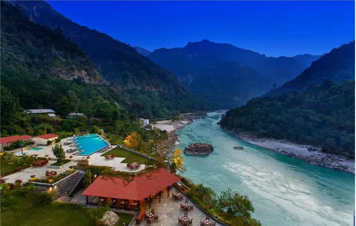
Best Airbnbs in Rishikesh: Yoga Retreats and Rafting Camps
Find the best Airbnbs in Rishikesh for yoga retreats, rafting camps, and spiritual stays with location-wise guide, pricing tips, and booking advice.
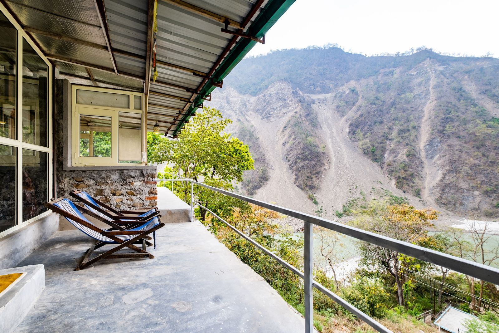
Homestays in Rishikesh Uttarakhand: Best Stays
Discover best homestays in Rishikesh Uttarakhand! Find riverside stays, budget options, prices & complete guide for yoga capital.
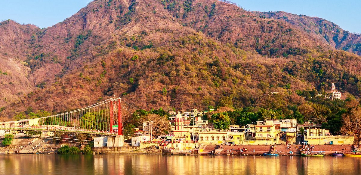
Places to Visit in Rishikesh: Yoga Ashrams, Ghats & Adventure Points
Discover the best places to visit in Rishikesh including Laxman Jhula, Triveni Ghat, adventure activities, ashrams and Neelkanth Mahadev Temple.
Never Miss an Adventure
Get the latest trekking guides, travel tips, and exclusive offers delivered straight to your inbox.