Dhankar Lake Trek Spiti: Trail Details, Height & Timing
Ananya Sharma
February 18, 2026
Complete guide to Dhankar Lake trek in Spiti Valley. Difficulty level, distance, height, best time, how to reach & detailed trekking guide with route map.
Introduction: The Turquoise Wonder of Spiti
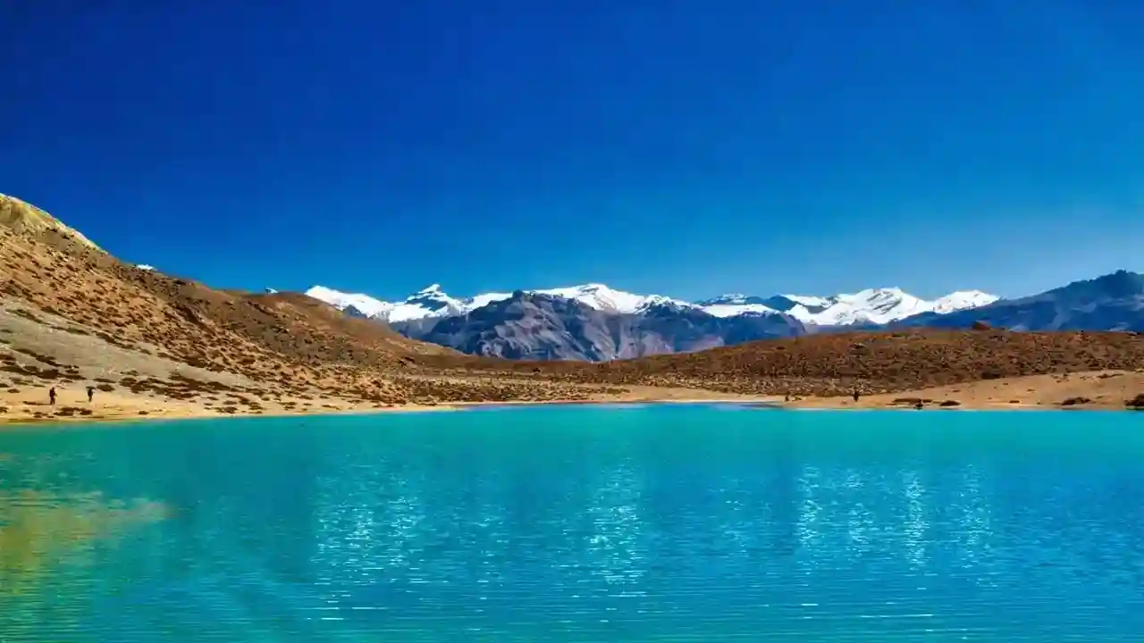
Tucked away in the remote corners of Himachal Pradesh's Spiti Valley lies a hidden gem that few travelers ever witness: Dhankar Lake, also known as Dhankar Tso. This pristine high-altitude lake, sitting at 4,270 meters (14,010 feet) above sea level, remains one of Spiti's best-kept secrets. The journey to this turquoise wonder is not for the faint-hearted—it demands effort, determination, and a spirit of adventure—but the rewards are beyond imagination.
Dhankar Lake trek offers an authentic Himalayan experience, far removed from the crowded tourist trails. As you ascend through rugged mountain terrain, breathing in the thin crisp air, every step brings you closer to one of the most stunning high-altitude lakes in the Trans-Himalayan region. The lake's crystal-clear waters reflect the surrounding peaks like a perfect mirror, creating a spectacle that seems almost surreal.
What makes this trek truly special is its isolation. Unlike the popular Chandratal Lake which sees hundreds of visitors during peak season, Dhankar Lake remains relatively unexplored, preserving its pristine beauty and spiritual atmosphere. For trekkers seeking solitude, raw natural beauty, and a genuine connection with the Himalayas, this trek delivers an experience that transforms you.
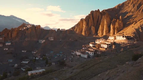
The trek starts from the historic Dhankar village, home to the ancient Dhankar Monastery perched dramatically on a cliff edge. This combination of spiritual heritage and natural adventure makes the Dhankar Lake trek a uniquely fulfilling experience—where Tibetan Buddhist culture meets raw Himalayan wilderness.
Dhankar Lake Trek Overview
Before embarking on this adventure, it's essential to understand what the Dhankar Lake trek entails. This is not a casual nature walk—it's a genuine high-altitude Himalayan trek that requires preparation, fitness, and respect for the mountains.
| Parameter | Details |
|---|---|
| Trek Duration | 2-3 hours one way (5-6 hours total) |
| Total Distance | 3-4 km approximately (round trip) |
| Lake Altitude | 4,270 meters (14,010 feet) |
| Starting Point | Dhankar Village (3,894 meters) |
| Trek Type | Moderate to Difficult |
| Best Season | June to September |
| Altitude Gain | 376 meters from village to lake |
| Terrain | Rocky, scree, narrow mountain paths |
| Guide Required | Not mandatory but recommended |
| Stay Options | Return to village or camping (with permission) |
The trek might seem short in distance, but the high altitude, steep ascent, and challenging terrain make it a demanding endeavor. This is not a trek to underestimate—proper preparation is key to a safe and enjoyable experience. The thin air at this altitude means your body works harder, and what would be an easy hike at lower elevations becomes significantly more challenging.
Difficulty Level and Terrain Analysis
Understanding the difficulty level of the Dhankar Lake trek is crucial for proper preparation. This trek falls into the moderate to difficult category, primarily due to the high altitude and technical terrain challenges.
Overall Difficulty: Moderate to Difficult
The trek's difficulty comes from multiple factors that combine to create a challenging but rewarding experience:
Steep Ascent
The trail from Dhankar village to the lake involves a continuous steep climb. While the distance is only about 1.5-2 kilometers one way, the elevation gain of 376 meters over this short distance means a consistently steep gradient. There are sections where the climb becomes particularly sharp, requiring careful foot placement and regular breaks.
The ascent is not uniform—it varies from gradual inclines to near-vertical stretches. This variation in steepness keeps the trek engaging but also demands constant physical effort. Your cardiovascular system works overtime in the thin air, making even moderate sections feel challenging.
Rocky Terrain and Loose Scree
The path to Dhankar Lake is primarily rocky, with significant sections covered in loose gravel and scree. Walking on scree requires a specific technique—placing your feet flat and testing stability before transferring your weight. The loose stones can slip underfoot, making progress slower and more energy-intensive.
In some sections, the trail becomes quite narrow, with loose gravel on both sides. This requires good balance and concentration. The risk of twisting an ankle is real, especially during the descent when gravity works against you. Quality trekking shoes with excellent grip are essential for safety.
Exposed Sections
Parts of the trail traverse exposed mountain edges with significant drops on one side. While these sections are not dangerously technical, they can be intimidating for trekkers with a fear of heights. The path is generally wide enough for safe passage, but the exposure adds a psychological challenge to the physical effort.
During windy conditions, these exposed sections can feel more precarious. The wind tends to pick up in the afternoons, so starting your trek early in the morning helps avoid both the heat and the stronger winds.
High Altitude Challenge
At 4,270 meters, Dhankar Lake sits in an altitude zone where oxygen levels are approximately 60% of sea level. Even if you're acclimatized in Kaza or Dhankar village (which sits at 3,894 meters), the additional 376 meters of elevation gain during the trek can trigger mild altitude symptoms.
Common symptoms at this altitude include shortness of breath, faster heartbeat, dizziness, and fatigue. These are normal responses to reduced oxygen availability and usually resolve with rest and proper hydration. However, it's crucial to listen to your body—if symptoms worsen (severe headache, nausea, confusion), you must descend immediately.
Fitness Requirements
To attempt the Dhankar Lake trek safely and enjoyably, you need:
- Good cardiovascular fitness: Regular cardio exercise (running, cycling, swimming) for at least 4-6 weeks before your trek significantly improves your endurance at altitude.
- Leg strength: Squats, lunges, and stair climbing prepare your legs for the continuous climb. Strong legs also help prevent knee injuries during the descent.
- Core strength: A strong core improves balance on uneven terrain and reduces back strain during the trek.
- Previous trekking experience: While not strictly necessary, experience with high-altitude treks helps you understand your body's responses and pace yourself appropriately.
Who Should Avoid This Trek?
The Dhankar Lake trek is not suitable for:
- Complete beginners with no prior trekking experience
- People with a fear of heights
- Individuals with heart conditions, respiratory problems, or high blood pressure (without doctor's approval)
- Those with limited time who cannot acclimatize properly
- Children under 12 years old (unless experienced trekkers)
- Pregnant women
If you're unsure about your fitness level or health conditions, consult a doctor familiar with high-altitude travel before attempting this trek.
Detailed Trek Route and Distance
Understanding the trek route helps you prepare mentally and physically for the journey ahead. The trail to Dhankar Lake is well-defined but challenging, offering spectacular views that make every step worthwhile.
Starting Point: Dhankar Village
The trek begins from Dhankar village, a picturesque settlement at 3,894 meters. Most trekkers start near the new Dhankar Monastery, which serves as an easily recognizable landmark. Before beginning your trek, it's worth spending some time exploring the ancient monastery perched on the cliff edge—its spiritual energy sets a perfect tone for the adventure ahead.
The village itself offers stunning views of the Spiti and Pin river confluence below. Traditional mud-brick houses with prayer flags fluttering in the wind create a quintessential Spiti scene. Take a moment to appreciate the harsh beauty of this landscape where life has thrived for centuries against all odds.
Section 1: Village Outskirts to Base Area
Duration: 30-40 minutes | Difficulty: Easy to Moderate
The initial section of the trek takes you through the upper reaches of Dhankar village. You'll pass traditional houses, barley fields (in season), and several chortens (Buddhist shrines). The path here is relatively gentle, allowing your body to warm up for the steeper sections ahead.
This section offers beautiful views of the valley below. You can see the Spiti River winding through the barren mountains, creating a stark contrast of blue water against brown earth. The prayer flags that line the trail add splashes of color to the monochrome landscape.
As you leave the village behind, the terrain becomes progressively rockier. The vegetation thins out, and you enter the classic high-altitude desert ecosystem that characterizes Spiti Valley. The silence here is profound, broken only by the wind and the occasional call of a lammergeier (bearded vulture) circling overhead.
Section 2: The Steep Ascent
Duration: 45-60 minutes | Difficulty: Difficult
This is the most challenging part of the trek. The trail begins a steep climb up the mountainside, switching back repeatedly to manage the elevation gain. The path becomes rocky and uneven, requiring careful footing.
The scree slope in this section can be particularly tricky. Each step can cause loose stones to slide, making progress slower. Trekking poles are incredibly helpful here, providing stability and reducing the load on your knees. Take frequent breaks—not out of weakness, but as a smart strategy to manage your energy and acclimatize gradually.
As you climb, the views become increasingly dramatic. Looking back, you can see Dhankar Monastery perched on its cliff, appearing smaller with each step you ascend. The river confluence below takes on a different perspective from this height.
The thin air becomes noticeable during this section. Don't be embarrassed to stop frequently to catch your breath. Pace yourself—this is not a race. The mountain will still be there when you reach the top.
Section 3: Final Approach to the Lake
Duration: 20-30 minutes | Difficulty: Moderate
After the steep ascent, the trail levels out somewhat as you approach the lake basin. The terrain remains rocky but the gradient decreases. You might start seeing glimpses of the lake through the surrounding peaks—a teaser that motivates you for the final push.
This section traverses along the mountainside with stunning views on both sides. To your left, the valley floor drops away dramatically. To your right, the peaks that cradle the lake loom larger. The sense of wilderness here is complete—there are no signs of human habitation, just raw nature in all its glory.
Arrival at Dhankar Lake
The moment you crest the final ridge and see Dhankar Lake spread out before you is magical. The lake, smaller than you might expect but perfectly formed, sits in a natural amphitheater of peaks. Its turquoise-blue waters reflect the sky and surrounding mountains with mirror-like clarity.
The lake's size varies depending on the season—after snowmelt in early summer, it's fuller. By late autumn, it recedes somewhat but remains equally beautiful. The water is freezing cold, formed from melting snow and mountain springs.
The area around the lake is relatively flat, offering a perfect spot to rest, eat lunch, and simply absorb the incredible surroundings. The silence here, punctuated only by the wind and occasional bird calls, creates a profound sense of peace. Many trekkers describe feeling a spiritual connection at the lake—a moment of clarity and gratitude.
Return Journey
Duration: 1.5-2 hours | Difficulty: Moderate (easier on lungs, harder on knees)
The descent follows the same route back to the village. While physically easier on your cardiovascular system (no climbing), the descent can be tough on your knees and requires concentration to maintain footing on the loose scree.
Take your time on the descent. The downward momentum might tempt you to rush, but haste increases the risk of slips and falls. Use trekking poles to take pressure off your knees. Stop frequently to enjoy the views—you'll see the landscape from a different perspective on the way down.
Most trekkers complete the round trip in 5-6 hours, including time spent at the lake. If you're a photographer or someone who savors the journey, plan for a longer day. There's no shame in taking 7-8 hours—enjoy the experience at your own pace.
Best Time to Visit Dhankar Lake
Timing your Dhankar Lake trek correctly is crucial for safety and enjoyment. The extreme climate of Spiti Valley means access is limited to a specific window, and within that window, conditions vary significantly.
| Season | Months | Temperature | Pros | Cons |
|---|---|---|---|---|
| Early Summer | June | 5-15°C | Recent snowmelt, lake is full, wildflowers blooming, pleasant trekking weather | Some snow patches on trail, streams might be swollen |
| Peak Summer | July-August | 10-20°C | Warmest weather, trail completely clear, best camping conditions | Occasional rain, more tourists, cloudy days possible |
| Early Autumn | September | 5-18°C | Best time overall—clear skies, stable weather, excellent visibility | Nights getting colder, water levels in lake lower |
| Late Autumn | October | 0-12°C | Fewer crowds, golden landscape colors, crystal clear views | Very cold nights, risk of early snow, limited services |
| Winter | Nov-May | -20 to 5°C | Snow landscapes, complete isolation | Not accessible, trail under snow, extreme cold |
Ideal Time: September
September is widely considered the best month for the Dhankar Lake trek. The monsoon rains have ended, skies are clear, temperatures are pleasant during the day, and the visibility is exceptional. The lake reflects the deep blue sky perfectly, creating spectacular photographic opportunities.
September also brings the advantage of thinner crowds compared to July-August. By this time, most summer tourists have returned home, leaving the trails quieter. You're more likely to have the lake to yourself, or share it with just a few other trekkers.
June: The Awakening
Early summer (June) is an excellent time for the trek if you want to see the lake at its fullest. Snow from the winter has just melted, filling the lake to its maximum capacity. The surrounding mountains still have snow patches, creating a stunning contrast with the brown earth and blue water.
June brings wildflowers to the lower sections of the trek. The high-altitude desert briefly transforms with patches of green and colorful flowers—a fleeting beauty that makes early summer treks special. However, be prepared for colder temperatures than later months, especially in the mornings and evenings.
July-August: Peak Season
These months offer the warmest weather and most accessible conditions. The trail is completely free of snow, streams are manageable, and camping is comfortable. The lake is easily accessible, and the days are long, giving you plenty of time to complete the trek at a leisurely pace.
However, July-August is also when Spiti sees its maximum tourist influx. You might encounter other trekkers on the trail, and accommodation in Dhankar village might be fully booked. Occasional rain showers occur during these months, though Spiti being a cold desert receives much less rainfall than other parts of Himachal Pradesh.
October: The Quiet Finale
October offers a different experience. The landscape takes on golden hues as autumn sets in. The air is crisp and clear, offering exceptional visibility—the surrounding peaks appear sharper and closer. Crowds have thinned out significantly, and you might have the entire lake to yourself.
The trade-off is the cold. Nights in October drop below freezing, and daytime temperatures, while pleasant in the sun, can be chilly in the wind. By late October, there's always a risk of early snowfall which can make the trek dangerous. If you're trekking in October, monitor weather forecasts closely and be prepared to cancel if conditions deteriorate.
Winter: Not Recommended
From November to May, Dhankar Lake is not accessible for trekking. The trail is buried under snow, temperatures are extreme (dropping to -30°C in January), and the risk of avalanches exists in certain sections. Access roads to Dhankar village itself are often blocked.
Only experienced winter mountaineers with proper equipment, training, and local support should consider attempting this trek in winter—and even then, it's an expedition, not a trek. For 99% of travelers, winter is a no-go period.
How to Reach Dhankar Village
Before you can attempt the Dhankar Lake trek, you need to reach Dhankar village—the starting point of your adventure. The journey to Dhankar is an experience in itself, taking you through some of the most spectacular landscapes in the Himalayas.
From Kaza: The Final Leg
Distance: 32 kilometers | Time: 1.5 hours | Route: Kaza - Schichling - Dhankar
Kaza, the main town of Spiti Valley, serves as the base for most travelers. From Kaza, you need to travel to Schichling (24 km), where the road to Dhankar begins. The Kaza-Schichling stretch is reasonably well-paved and offers smooth driving.
From Schichling, an 8-kilometer road climbs steeply to Dhankar village. This road is narrow, rough, and has sharp bends—driving requires concentration and experience. The road is not tarred and becomes treacherous during rain. Most travelers hire experienced local drivers for this stretch.
The journey from Kaza to Dhankar offers spectacular views. As you climb, the Spiti Valley spreads out below you. The confluence of the Spiti and Pin rivers becomes visible, and on a clear day, you can see snow-capped peaks in the distance.
Transportation Options
Private Taxi
The most convenient and recommended option. Hire a taxi from Kaza for the round trip (including return the same day or next day). Expect to pay ₹2,500-3,500 for a full day, depending on your negotiation skills and season (prices are higher during peak season).
The advantage of a private taxi is flexibility—you can leave when you want, stop for photography, and have the vehicle waiting for your return from the trek. Ask your hotel in Kaza to arrange a reliable taxi with an experienced driver familiar with the Dhankar road.
HRTC Bus
Himachal Road Transport Corporation operates bus services between Kaza and Dhankar, but they're extremely limited and irregular. There might be one bus per day, or none on some days. The bus fare is nominal (₹50-100), but the schedule rarely aligns with trekking plans.
If you're relying on the bus, check the current schedule at Kaza bus stand a day in advance. Be prepared for the possibility that no bus service is operating. The bus is a good option if you're on a tight budget and have flexible plans.
Shared Cabs
During peak tourist season, shared cabs sometimes operate between Kaza and Dhankar. These are cheaper than private taxis (₹200-300 per person) but operate on a fill-up-first basis—the vehicle leaves only when all seats are occupied.
Shared cabs are unpredictable. You might wait for hours for the vehicle to fill up, or it might not operate at all if there aren't enough passengers. Only consider this option if you have time to spare and no fixed schedule.
Self-Drive or Motorcycle
Experienced riders can rent motorcycles in Kaza and ride to Dhankar. The 8-kilometer climb from Schichling to Dhankar is challenging—steep, narrow, and with loose gravel. Only attempt this if you have experience riding in mountains and are comfortable with exposed roads.
Cars can also be rented in Kaza or brought from Manali/Shimla. However, the Dhankar road is not recommended for inexperienced drivers. If you're self-driving, take it slow, use horn on blind curves, and be prepared for vehicles coming from the opposite direction on the narrow stretches.
Reaching Kaza: The Main Gateway
Since most travelers reach Dhankar via Kaza, here's how to get to Kaza:
From Manali (June-October)
Route: Manali - Rohtang Pass - Kunzum Pass - Losar - Kaza
Distance: 200 kilometers | Time: 8-10 hours
Road Condition: Rough with patches, multiple river crossings
This is the most popular route during the season it's open (June to October when Kunzum Pass is accessible). The drive is spectacular but tiring. Leave Manali early (5-6 AM) to reach Kaza by evening. Shared cabs, private taxis, and buses operate on this route.
From Shimla (March-November)
Route: Shimla - Rampur - Powari - Nako - Tabo - Kaza
Distance: 425 kilometers | Time: 2 days (with overnight stop)
Road Condition: Mostly paved, better than Manali route
The Shimla route is longer but more reliable, remaining open for more months of the year. The distance cannot be covered in one day—you'll need to stop overnight at Kalpa, Powari, or Nako. This route is safer and more comfortable, though it takes more time.
Important Travel Tips
- Last ATM/Petrol: Kaza is the last place with reliable ATM and petrol pump services. Fill up your tank and withdraw cash in Kaza before heading to Dhankar.
- Start Early: Whether driving from Manali or just Kaza to Dhankar, start early. Mountain driving should be avoided after dark.
- Road Conditions: Check current road conditions before starting. The Spiti roads are prone to landslides and temporary blockages.
- Motion Sickness: If you're prone to motion sickness, take medication before the journey. The roads are winding and can trigger nausea.
- Acclimatization: Spend at least one night in Kaza (or two nights if coming directly from Manali/Shimla) before attempting the Dhankar Lake trek. Proper acclimatization is non-negotiable for safe high-altitude trekking.
Trek Preparation and Essential Gear
Proper preparation is the difference between an enjoyable trek and a miserable (or dangerous) experience. The remote location and high altitude mean you can't afford to forget essential items or make poor preparation decisions.
Acclimatization: The Foundation of Safety
Minimum Time: 2-3 nights in Kaza/Dhankar before the trek
Acclimatization is not optional—it's essential. At 4,270 meters, your body needs time to adapt to reduced oxygen levels. Rush this process, and you risk Acute Mountain Sickness (AMS), which can be life-threatening.
Recommended Acclimatization Schedule:
- Night 1: Stay in Kaza (3,800 meters) if arriving from Manali/Shimla
- Night 2: Another night in Kaza or move to Dhankar village (3,894 meters)
- Day 3: Attempt the Dhankar Lake trek
This gradual ascent gives your body time to produce more red blood cells to carry oxygen efficiently. During acclimatization days, stay hydrated, avoid alcohol and smoking, eat light meals, and rest. Don't rush—there's no prize for reaching the fastest.
AMS Symptoms to Watch For:
- Mild: Headache, nausea, dizziness, fatigue, shortness of breath
- Severe: Severe headache that doesn't improve with medication, vomiting, confusion, inability to walk straight, breathlessness at rest
If you experience mild symptoms, rest, hydrate, and take Diamox (consult your doctor about dosage before your trip). If symptoms are severe, descend immediately—do not wait, do not attempt to trek up. AMS can progress rapidly and become fatal.
Essential Trekking Gear
Footwear
Trekking Shoes: This is your most important gear investment. Quality trekking shoes with good ankle support and aggressive grip are essential. The rocky, scree-covered trail demands footwear that provides stability on loose terrain. Brands like Quechua, Columbia, Salomon, or Forclaz offer good options in the ₹3,000-6,000 range.
Breaking in: Never wear new shoes on a trek. Buy your shoes at least 2-3 weeks before your trip and wear them for walks to break them in. This prevents blisters and ensures comfort.
Socks: Wear synthetic or wool trekking socks that wick moisture away from your feet. Cotton socks retain sweat, leading to blisters. Carry 2-3 pairs and change if your feet get wet.
Clothing
Layering System: The key to high-altitude comfort is layering. Temperatures can vary dramatically from the village to the lake and from morning to afternoon.
- Base Layer: Synthetic or merino wool t-shirt that wicks sweat. Avoid cotton.
- Mid Layer: Fleece jacket or pullover for insulation.
- Outer Layer: Windproof and water-resistant jacket. The wind at the lake can be strong, and a good jacket makes a huge difference to comfort.
- Trekking Pants: Quick-dry synthetic pants. Convertible pants (zip-offs) are versatile.
- Warm Hat: Essential. A lot of body heat is lost through the head, and it can be chilly at the lake.
- Sun Hat: The sun at this altitude is intense. A wide-brimmed hat or cap provides protection.
- Gloves: Light gloves for warmth, especially if trekking in June or September when mornings are cold.
Hydration and Nutrition
Water: Carry at least 2-3 liters of water per person. Dehydration accelerates AMS and causes fatigue. Use a hydration pack (camelbag) or water bottles. At high altitude, you need to drink more than usual—aim for 4-5 liters throughout the day.
Water Purification: If you plan to refill from streams (not recommended unless necessary), carry water purification tablets or a filter. Most trekkers carry all their water from Kaza/Dhankar village.
Food: High-energy, lightweight snacks are essential. Good options include:
- Energy bars (Protein bars, muesli bars)
- Dry fruits and nuts (almonds, walnuts, raisins)
- Dark chocolate (quick energy boost)
- Glucose or electoral powder (mix with water to prevent cramps)
- Sandwiches or rotis with simple filling (carry from your hotel)
Avoid heavy, greasy foods that are hard to digest at altitude. Eat small amounts frequently rather than one large meal.
Sun Protection
Sunscreen: SPF 50+ sunscreen is non-negotiable. At 4,000+ meters, UV radiation is approximately 40% stronger than at sea level. You can get sunburned in less than 30 minutes, even on cloudy days. Apply liberally and reapply every 2 hours.
Sunglasses: UV-protected sunglasses with good coverage. The bright sunlight reflecting off the lake and rocks can cause snow blindness (photokeratitis) or severe eye strain.
Lip Balm: Your lips will get chapped at high altitude. Carry a lip balm with SPF protection.
First Aid and Emergency
Basic First Aid Kit:
- Band-aids and antiseptic cream for cuts
- Blister tape/moleskin for foot care
- Painkillers (Paracetamol/Ibuprofen) for headaches
- Diamox (Acetazolamide) for AMS (consult your doctor first)
- Anti-nausea medication
- Oral rehydration salts
- Small roll of bandage and cotton
Emergency Items:
- Whistle (for signaling in emergencies)
- Lighter/matches (for warmth if stranded)
- Emergency blanket (compact, reflects body heat)
- Power bank for your phone
Navigation and Communication
Trekking Poles: Highly recommended, especially for the steep ascent and scree sections. Poles reduce knee strain by up to 30% and provide stability on loose terrain. Adjustable poles are best so you can lengthen them for descents.
Offline Maps: Download offline maps (Google Maps or Maps.me) before leaving Kaza—there's no internet on the trek. However, the trail is generally well-defined, and you're unlikely to need navigation if you follow the visible path.
Mobile Connectivity: BSNL and Jio networks work partially in Kaza and might work sporadically during parts of the trek. Don't depend on your phone for emergencies—inform someone at your hotel about your trek plans before leaving.
Photography Equipment
Camera: If you're a photography enthusiast, the lake offers spectacular shots. Carry extra batteries—cold drains battery faster. Keep batteries in an inner pocket close to your body to keep them warm.
Lens: A wide-angle lens (16-35mm) is ideal for landscape shots of the lake and mountains. A telephoto lens (70-200mm) helps compress the landscape and create dramatic compositions of peaks reflected in the water.
Filters: A circular polarizer reduces glare from the water and enhances the blue of sky and lake. Neutral density filters allow long exposures if you want to smooth water reflections.
What NOT to Bring
- Heavy loads: Keep your day pack under 5 kg. Every extra kilogram makes the trek significantly harder at altitude.
- Valuables: Expensive jewelry, excessive cash, or electronics you don't need. Leave them in your hotel safe.
- Cotton clothing: Cotton gets wet with sweat and stays wet, making you cold. Synthetic or wool fabrics are essential.
- New shoes: As mentioned earlier, unbroken shoes cause blisters.
Nearby Attractions and Experiences
The Dhankar Lake trek is often part of a larger Spiti Valley adventure. While the lake itself is worthy of being a destination, the surrounding region offers numerous attractions that deserve your time and attention.
Dhankar Monastery: The Cliff-Top Wonder
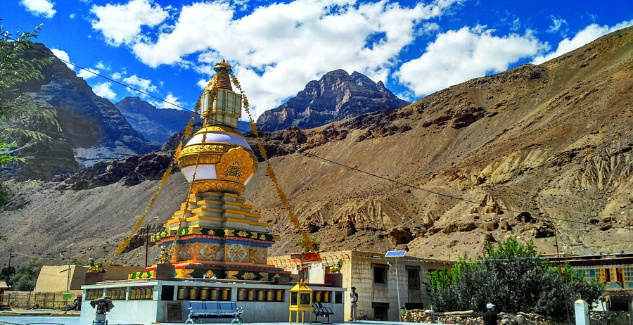
Before or after your lake trek, explore the ancient Dhankar Monastery perched dramatically on a cliff edge. This 12th-century Gelugpa monastery, the former capital of Spiti Valley, offers stunning views of the Spiti and Pin river confluence.
The monastery complex includes both the old structure (precariously positioned and showing signs of age) and a newer building where religious activities continue. Spend time exploring the prayer halls, admiring ancient murals, and witnessing monks performing their daily rituals. The spiritual atmosphere of the monastery pairs perfectly with the natural beauty of the lake trek.
Allow 2-3 hours for exploring the monastery complex. The morning prayer ceremony (usually 6-7 AM) is particularly moving if you can wake up early. The monastery is free to enter, but donations for its maintenance are appreciated.
Dhankar Fort Ruins
Above the village, the ruins of the old Dhankar Fort offer a glimpse into Spiti's strategic importance historically. The fort, once a defensive structure protecting the valley, now stands as weathered stone walls against the dramatic sky.
The hike to the fort ruins is short but steep, offering excellent views of the village and surrounding valley. It's worth the quick detour for photographers and history enthusiasts. The fort represents the 'Dhankar' (fort on a cliff) aspect that gave the village its name.
Pin Valley National Park
Located near Dhankar, the Pin Valley National Park is a protected area renowned for its unique cold desert ecosystem and wildlife. The park is home to the endangered Snow Leopard, Himalayan Ibex, Blue Sheep (Bharal), and numerous bird species including the Golden Eagle and Lammergeier.
While snow leopard sightings are rare and usually require winter expeditions, the park's dramatic landscapes—deep gorges, snow-capped peaks, and virgin forests—are worth exploring any time of year. Several trekking routes originate here, including the challenging Pin Bhabha Pass trek connecting Spiti to Kinnaur.
Entry to the national park requires permits (easily arranged in Kaza or at the park entrance). The park headquarters in Mudh village serves as a starting point for several treks.
Kaza: Spiti's Administrative Center
At 32 kilometers from Dhankar, Kaza serves as the base for most Spiti explorations. Spend time here acclimatizing while exploring the town's attractions:
- Sakya Tangyud Monastery: One of the largest in Spiti, featuring beautiful architecture and ancient scriptures.
- Local Markets: Browse shops selling handicrafts, souvenirs, and local produce.
- Spiti Riverside Cafe: Famous for its yak cheese products and stunning river views.
- Atm and Services: Kaza has the last reliable ATM, petrol pump, medical facilities, and internet connectivity before venturing deeper into Spiti.
Kaza also offers diverse accommodation options—from budget homestays to mid-range hotels—and restaurants serving both local Spitian cuisine and familiar dishes. Stock up on supplies here before heading to more remote areas.
Kibber Village: High-Altitude Living
At 4,270 meters, Kibber is one of the world's highest inhabited villages with permanent road connectivity. The village serves as a base for several treks and wildlife expeditions—winter brings opportunities to spot the elusive snow leopard in the surrounding mountains.
Kibber's traditional architecture, small monastery, and stunning views make it worth a visit. The village is accessible by road from Kaza (20 km) and offers homestay experiences for those wanting to immerse themselves in high-altitude village life.
Komic and Hikkim: World's Highest Villages
En route from Kaza to Dhankar, you can detour to Komic (4,587 meters)—one of the world's highest permanently inhabited villages—and Hikkim (4,433 meters)—home to the world's highest post office.
In Komic, visit the small monastery with its ancient murals and enjoy the feeling of being literally on the roof of the world. In Hikkim, send postcards to friends and family from the post office—the special postmark makes a unique travel souvenir.
These villages offer a glimpse into life at extreme altitudes, where traditional Spitian culture remains largely intact. The locals are welcoming, and homestays provide basic accommodation for those wanting to experience village life firsthand.
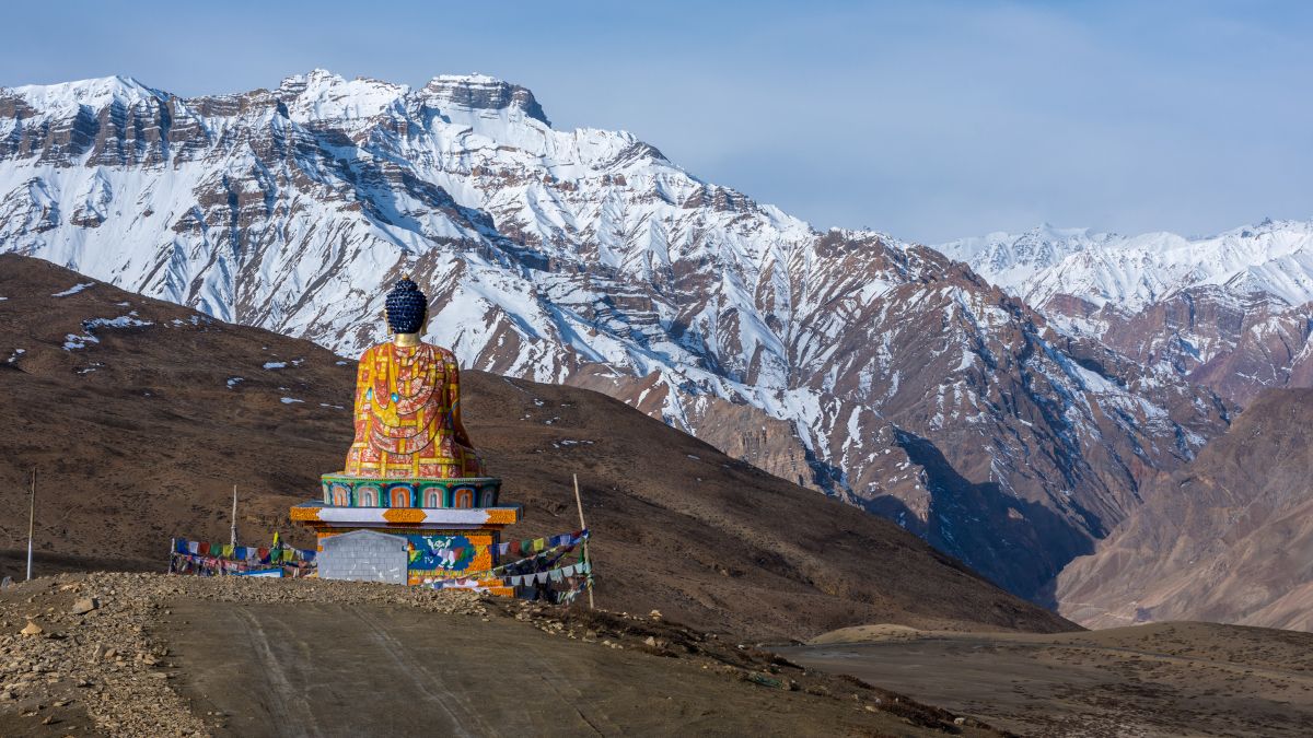
Langza Village: Fossils and Golden Buddha
Langza is famous for its magnificent golden Buddha statue overlooking the village and the abundance of marine fossils found in the surrounding mountains. Yes, marine fossils in the Himalayas—evidence that this region was once under the Tethys Sea millions of years ago.
You can hire local guides to take you fossil hunting—small ammonites and other marine fossils are commonly found. The village walk takes you past Spitian homes, barley fields, and chortens, with the soaring Chau Chau Kang Nilda peak towering above.
Langza is also one of the best places in Spiti for stargazing. The high altitude, minimal light pollution, and clear air create perfect conditions for night sky photography. If you're staying overnight, the Milky Way often appears so bright it casts shadows.
Tabo Monastery: The Ajanta of the Himalayas
Located about 50 kilometers from Dhankar, Tabo Monastery is renowned for its exquisite murals often compared to the Ajanta Caves. Founded in 996 AD, Tabo is the oldest continuously operating Buddhist enclave in India and a UNESCO World Heritage Site.
The monastery complex houses nine temples, 23 chortens, and a monk's chamber. The wall paintings, depicting various Buddhist deities and mandalas, are remarkably preserved and offer insight into Tibetan Buddhist art and iconography.
Tabo can be visited as a day trip from Kaza or Dhankar, though staying overnight allows you to experience the morning prayers and explore the complex at a leisurely pace.
Conclusion: A Trek Worth Every Step
The Dhankar Lake trek is not just a physical challenge—it's a journey into one of the most remote and beautiful corners of the Himalayas. From the moment you leave Dhankar village, climbing through rugged terrain with the ancient monastery perched on its cliff fading below, to the first glimpse of turquoise waters reflecting the infinite sky, this trek delivers an experience that transforms you.
What makes this trek special is its authenticity. Unlike commercialized trekking destinations where you share the trail with hundreds of others, Dhankar Lake remains largely unexplored. The path demands genuine effort—the steep ascent, the rocky scree, the thin air ensuring this is no casual nature walk. But it's precisely this challenge that makes reaching the lake so rewarding.
The lake itself is a masterpiece of nature. Its perfectly still waters, reflecting the surrounding peaks with mirror-like clarity, create a scene that feels almost unreal. The silence here is profound, broken only by the wind and the occasional bird call. In this moment, all the exertion of the trek fades away, replaced by a sense of peace and wonder that only high-altitude wilderness can provide.
Beyond the physical beauty, the trek offers spiritual nourishment. The combination of visiting the ancient Dhankar Monastery, witnessing traditional Spiti life in the village, and experiencing the raw majesty of the lake creates a holistic Himalayan experience. You understand why this landscape has drawn seekers and travelers for centuries—and why the locals who call this harsh terrain home wouldn't live anywhere else.
For adventure travelers, the Dhankar Lake trek checks all the boxes: high altitude, challenging terrain, spectacular scenery, cultural immersion, and the satisfaction of completing something demanding. Whether you're an experienced trekker or someone who's reasonably fit and seeking their first high-altitude challenge, this trek delivers memories that will last a lifetime.
As you descend back to the village, tired but exhilarated, you'll carry more than just photographs. You'll carry the knowledge that you pushed your limits, adapted to challenging conditions, and experienced a corner of the Himalayas that few ever see. In our increasingly connected and noisy world, places like Dhankar Lake offer a rare opportunity to disconnect, to be present in the moment, to feel small against the vastness of the mountains—and in that smallness, to find something profound.
The mountains don't call to everyone. But for those who hear the call, for those willing to make the journey and put in the effort, the rewards are beyond measure. The turquoise waters of Dhankar Lake, reflecting mountains that have stood for millennia, are waiting. All you have to do is take the first step.
Location
Frequently Asked Questions
Q1.How difficult is the Dhankar Lake trek?
Q2.What is the distance of Dhankar Lake trek?
Q3.What is the height of Dhankar Lake?
Q4.How long does the Dhankar Lake trek take?
Q5.What is the best time to visit Dhankar Lake?
Q6.How to reach Dhankar village for the trek?
Q7.What should I carry for Dhankar Lake trek?
Q8.Is a guide required for Dhankar Lake trek?
Q9.Is Dhankar Lake trek safe for beginners?
Q10.Can we camp at Dhankar Lake?
Recommended For You
Dhankar Monastery Spiti: Monastery Visit, Trek Route & Stay Options
Discover Dhankar Monastery in Spiti Valley, a 900-year-old cliff-top wonder at 3,894 meters. Complete guide with Dhankar Lake trek, history, how to reach, timings & travel tips.
Tabo Monastery Spiti: Guide, History & Stay
Tabo Monastery in Spiti Valley guide! 1000-year-old temple complex, ancient Buddhist art, accommodation & how to reach.
Spiti Valley Trekking Guide: Best Routes, Itinerary & Tips 2026
Complete Spiti Valley trekking guide featuring Pin Parvati Pass, Chandratal Lake routes, itineraries, fitness preparation, gear checklist, and essential tips for 2026.
Never Miss an Adventure
Get the latest trekking guides, travel tips, and exclusive offers delivered straight to your inbox.