
8 Hill Stations Near Patnitop Kashmir: Distance & Route Details
Ananya Sharma
February 3, 2026
Explore 8 hill stations near Patnitop Kashmir within 150 km, including Sanasar, Nathatop, Kud, and Bhaderwah, with distance bands, routes, and travel tips.
Introduction
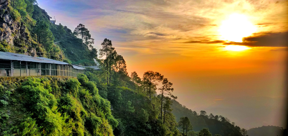
Patnitop is one of the easiest mountain breaks on the Jammu-Srinagar highway, but many travelers stop at one viewpoint and miss the wider circuit around it. If your search is focused on hill stations near Patnitop Kashmir, the better approach is to plan by distance band and road condition, not just by map radius. This guide covers eight nearby hill destinations and mountain towns you can combine with Patnitop for a practical road itinerary.
Instead of random detours, you will get a clear comparison of what is within 50 km, what fits a 50 to 100 km day trip, and what is realistic in the 100 to 150 km zone. Distances are approximate by road from Patnitop market area and can vary by exact stay location and diversion. For broader regional context, see hill stations in Jammu and Kashmir before finalizing your route.
Quick Facts Box
| Place | Approx Distance from Patnitop | Best For | Typical Time Needed |
|---|---|---|---|
| Kud | 10 km | Short halt, local market, sweets | 1-2 hours |
| Nathatop | 14 km | Snow views, open ridge points | 2-4 hours |
| Sanasar | 20 km | Meadow landscape, adventure activities | Half day to full day |
| Batote | 32 km | Transit halt with valley views | 2-3 hours |
| Doda | 75 km | Long valley drive, local town feel | Full day |
| Bhaderwah | 90 km | Scenic meadow belt, slower travel | 1-2 days |
| Banihal | 110 km | Mountain transit on Srinagar side route | Full day |
| Verinag | 145 km | Heritage spring garden and Kashmir gateway | Long day or overnight |
This cluster works well for road trippers starting from Jammu, Katra, or Udhampur and extending toward the Kashmir Valley.
Hill Stations Within 50 km of Patnitop
1. Kud (Approx 10 km)
Kud is the nearest and easiest hill stop from Patnitop. Most travelers know it as a quick snack and refreshment town, but it is useful as a practical halt before weather conditions change on higher stretches. If you are traveling with senior citizens or children, Kud offers a low-effort break without aggressive detours.
- Why visit: short access, basic facilities, classic road-break stop.
- Best for: first halt after Patnitop check-out.
- Trip style: same-day continuation.
2. Nathatop (Approx 14 km)
Nathatop is one of the most searched Patnitop nearby tourist places because the ridge views are strong and the approach is short. In colder months, this stretch is often chosen for snow-play experiences. In clear weather, it gives one of the best high-point visual frames in this micro-circuit.
- Why visit: ridge panorama and seasonal snow.
- Best for: quick mountain activity from Patnitop stay.
- Caution: road conditions can shift rapidly in winter weather.
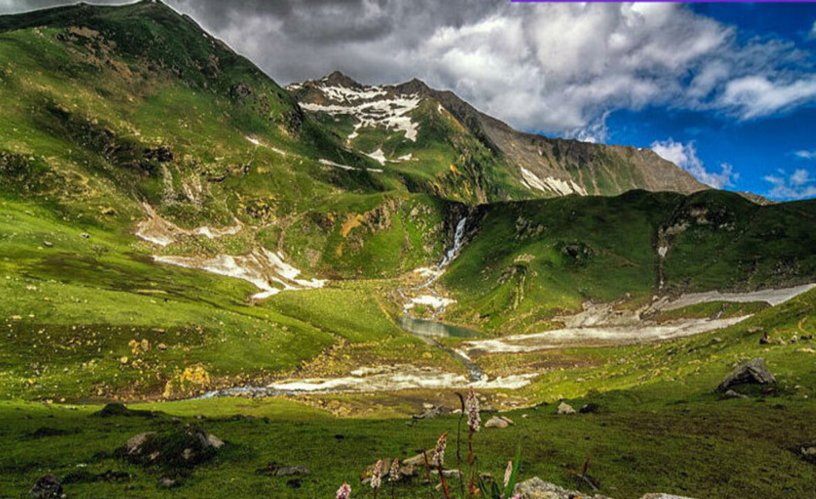
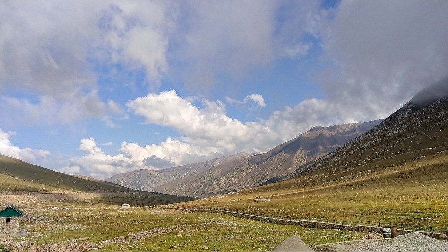
3. Sanasar (Approx 20 km)
Sanasar is usually the best hill station around Patnitop for travelers who want open meadow landscapes and a calmer pace than crowded hubs. The setting feels wider and less boxed-in than market towns, which makes it ideal for photography and soft adventure activities. If you want details on this destination, refer to Sanasar Lake Jammu Kashmir.
- Why visit: meadow views, outdoor activity options, quieter atmosphere.
- Best for: couples, photographers, and relaxed day trips.
- Stay option: combine as 1 night extension from Patnitop.
4. Batote (Approx 32 km)
Batote is often treated as a transit town, but it can still be a practical hill stop if you are splitting a longer Jammu to Srinagar journey. Valley visuals and road-side viewpoints make it useful for short resets, especially when traffic windows are uncertain.
- Why visit: logical break point on a highway itinerary.
- Best for: drivers who prefer shorter continuous stretches.
- Not ideal for: travelers looking for a full standalone holiday town.
Hill Stations 50-100 km from Patnitop
5. Doda (Approx 75 km)
Doda works for travelers who prefer a less commercial mountain-town experience. It is not a polished tourist hub, but that is exactly why some road trippers include it for local context and less crowded movement. The road drive is longer than short Patnitop loops, so start early and keep a return-time buffer.
- Why visit: lower crowd pressure and local town character.
- Best for: exploratory travelers with full-day flexibility.
- Road note: do not compress multiple long detours into one day.
6. Bhaderwah (Approx 90 km)
Bhaderwah is often called one of the most scenic belts in this side of Jammu division and is a strong pick if you want green valley visuals over crowded market activity. It suits travelers who want longer stays, short nature walks, and a slower mountain routine.
- Why visit: scenic valley character and cooler weather profile.
- Best for: 1 to 2 night mountain extension.
- Planning: verify accommodation and fuel before departure.
If your larger route includes pilgrimage traffic zones, combine planning with places to visit near Katra and keep road-time margins realistic.
Hill Stations 100-150 km from Patnitop
7. Banihal (Approx 110 km)
Banihal is usually a strategic mountain stop for travelers moving toward the Kashmir Valley. It is less about sightseeing density and more about route logic, weather adaptation, and highway timing. If your goal is a smooth transition toward Srinagar-side destinations, Banihal can be a practical midpoint.
- Why visit: route value between Jammu side and Kashmir side.
- Best for: long-haul road itineraries with staged movement.
- Keep in mind: weather and traffic may alter travel times quickly.
8. Verinag (Approx 145 km)
Verinag sits near the edge of this distance band and works well for travelers who want both mountain setting and historical garden character. It is a longer push from Patnitop, so most travelers either stay overnight or pair it with onward movement to Srinagar.
- Why visit: spring garden heritage and pleasant mountain environment.
- Best for: road trippers transitioning into Kashmir Valley circuit.
- Trip format: long day trip only if departure is very early.
For full valley planning after this point, use Kashmir travel guide and align dates with weather windows.
Patnitop to Srinagar Route Context
The Patnitop to Srinagar travel corridor is one of the most important planning factors in this region. Pure map distance is less useful than real driving conditions, convoy traffic, and weather variability. On clear days, progress can be smooth, but mountain segments can add delay with little notice.
| Route Segment | Approx Road Distance | Planning Note |
|---|---|---|
| Patnitop to Banihal | Approx 110 km | Keep fuel and food buffer |
| Patnitop to Verinag | Approx 145 km | Better with early departure |
| Patnitop to Srinagar | Approx 175-185 km | Start at daylight and track advisories |
If you are uncertain about transitions, review how to reach Jammu to Srinagar before locking hotel check-in times.
Best Time to Visit Hill Stations Near Patnitop
- March to June: easiest season for mixed sightseeing and road movement.
- July to September: green landscapes, but rain can slow mountain travel.
- October to November: clear views and balanced crowd levels.
- December to February: winter appeal and snow potential around high points like Nathatop, with stronger weather uncertainty.
If your focus is broader Kashmir planning, compare dates with best time to visit Kashmir for better alignment.
Practical Travel Tips
- Leave early from Patnitop for all 50+ km circuits and avoid tight sunset returns.
- Carry offline maps and keep essential contacts saved before entering weak-network stretches.
- Do not chain too many stops in one day; mountain drive fatigue builds fast.
- Keep one buffer meal stop and one weather buffer in every inter-city transfer.
- Book accommodation with parking confirmation if traveling by self-drive car.
- In winter, verify road status before leaving hotel, especially for ridge points.
Sample Itineraries
2-Day Micro Circuit
- Day 1: Patnitop stay + Nathatop + Kud local circuit.
- Day 2: Sanasar half-day and return toward base city.
3-Day Extended Circuit
- Day 1: Patnitop + Nathatop.
- Day 2: Sanasar + Batote viewpoints.
- Day 3: Bhaderwah or Doda drive and overnight return strategy.
4-Day Transition Circuit Toward Valley
- Day 1: Patnitop and local points.
- Day 2: Sanasar extension.
- Day 3: Banihal transit with weather buffer.
- Day 4: Verinag and onward to Srinagar-side stay.
Choose one itinerary pattern based on road stamina and weather, not social media checklist pressure.
Common Planning Mistakes to Avoid
- Choosing by map only: mountain travel time matters more than straight-line distance.
- Late departures: leave early so most hill driving happens in daylight.
- No weather buffer: keep at least half-day flexibility in winter and monsoon transitions.
- Overpacking stops: two quality stops are better than five rushed check-ins.
- Skipping fuel planning: refill whenever you find a reliable pump on longer valley routes.
These small planning corrections usually create the biggest improvement in comfort, safety, and overall trip quality. Most rushed itineraries fail because travelers underestimate drive fatigue and overestimate daytime usable hours in mountain corridors.
Final Take
The best hill stations near Patnitop Kashmir are not only the nearest ones, but the ones that match your travel window and driving comfort. A distance-first plan helps you avoid fatigue, improve safety margins, and still cover meaningful mountain experiences without rushing. Kud, Nathatop, and Sanasar are excellent short-range options. Bhaderwah and Doda suit deeper exploratory trips. Banihal and Verinag are ideal when you are moving toward the Kashmir Valley with a structured route plan.
When you plan by distance band and season, this circuit becomes far smoother and more rewarding than an unstructured road hop.
Location
Frequently Asked Questions
Q1.How many hill stations are near Patnitop?
Q2.Which is the nearest hill station to Patnitop?
Q3.What is Patnitop famous for?
Q4.What is the best time to visit hill stations near Patnitop?
Q5.Is Patnitop open during snowfall?
Q6.How far is Patnitop from Jammu?
Q7.How far is Patnitop from Srinagar?
Q8.Is Nathatop higher than Patnitop?
Recommended For You
Best Time to Visit Kashmir: Month-by-Month Weather & Activities
Plan the best time to visit Kashmir with month-by-month weather, snow and bloom seasons, and practical guidance for sightseeing, honeymoon, and family travel.
How to Travel from Jammu to Srinagar: Route, Time & Cost
Complete Jammu to Srinagar travel guide by flight, train, bus, and road with route tips, updated rail context, local transport, and planning advice.
Places to Visit in Katra Beyond Vaishno Devi: Nearby Attractions
Discover places to visit in Katra beyond Vaishno Devi with top nearby temples, scenic routes, practical itineraries, and travel tips for families and pilgrims.
Never Miss an Adventure
Get the latest trekking guides, travel tips, and exclusive offers delivered straight to your inbox.