Wari La Pass: The Forbidden Himalayan Pass in Ladakh
Rahul Garg
November 12, 2025
Conquer Wari La Pass in Ladakh at 5,312m. Discover the forbidden Himalayan pass - route, permits, best time, challenges & why it's India's ultimate adventure ride.
Introduction: The Forbidden Pass of Ladakh
Deep in the trans-Himalayan region of Ladakh lies Wari La Pass - one of the most remote, challenging, and breathtakingly beautiful mountain passes in India. At an elevation of 5,312 meters (17,427 feet), Wari La connects the Nubra Valley to the Shyok River valley, serving as an alternative route to the famous Khardung La. What makes Wari La extraordinary is its relative obscurity - while Khardung La sees thousands of visitors, Wari La remains traversed only by the most adventurous travelers and the occasional army convoy.
The name "Wari La" translates to "pass of the hidden valley," and the name couldn't be more appropriate. This pass winds through terrain so rugged and landscapes so otherworldly that you'll feel like you've stepped onto another planet. The journey takes you past pristine glaciers, turquoise lakes, ancient monasteries, and villages that seem frozen in time. For adventure motorcyclists, off-road enthusiasts, and those seeking to escape Ladakh's tourist trail, Wari La offers an authentic Himalayan experience that's increasingly rare to find.
Unlike better-known Ladakhi passes, Wari La has no permanent settlements, no tea shops, no phone connectivity, and virtually no traffic. You're entirely on your own in one of the most beautiful yet hostile environments on Earth. This isolation is precisely what makes Wari La special - the pass rewards those willing to venture off the beaten path with views and experiences that most travelers to Ladakh can only imagine.
About Wari La Pass
Geography and Location
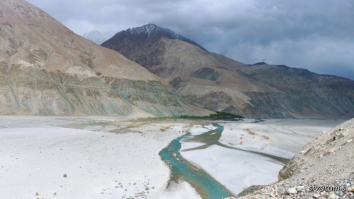
Wari La Pass is located in the Leh district of Ladakh, approximately 140 kilometers east of Leh city. The pass forms part of the lesser-known route connecting the Nubra Valley (famous for its sand dunes and Bactrian camels) with the Shyok River valley that leads toward Pangong Lake and eastern Ladakh.
The pass sits at 5,312 meters (17,427 feet) above sea level, making it one of the highest motorable passes in Ladakh (though slightly lower than Khardung La at 5,359 meters and Umling La at 5,799 meters). The road conditions are considerably more challenging than Khardung La - narrow, unpaved for most of its length, with steep gradients, loose gravel, and no barrier protection.
The terrain around Wari La is characterized by dramatic variations - lush green valleys in the lower sections give way to barren brown slopes, which then transform into snow-capped peaks and rocky scree near the summit. The views from the top encompass a stunning panorama of the Ladakh and Karakoram ranges, with multiple snow-capped peaks visible in all directions.
Why It's Called "The Forbidden Pass"
Wari La has earned the nickname "The Forbidden Pass" for several reasons:
- Extreme Isolation: No settlements or facilities for miles. You're completely self-reliant.
- Poor Road Conditions: The road is essentially a dirt track, challenging for all but experienced riders/drivers.
- Unpredictable Weather: Sudden snowstorms even in summer can block the pass for days.
- Army Control: The pass is occasionally closed for military exercises or due to its strategic location near the border.
- Limited Information: Very little documentation exists about the pass - no guidebooks, few blogs, no signboards.
- No Phone Connectivity: Complete isolation from the outside world.
These very challenges are what attract serious adventurers. Wari La isn't just a mountain pass - it's an expedition that tests your skills, preparation, and resolve.
Strategic Importance
Historically, Wari La has been an important trade route connecting Ladakh with Tibet. Today, it serves as a crucial strategic route for the Indian Army, providing an alternative supply line to the eastern sectors of Ladakh, especially when the main routes through Khardung La or Chang La are affected by weather or landslides.
The army maintains the pass minimally - enough for their convoys to pass, but not enough for comfortable tourist travel. This military use is part of why the pass is sometimes closed to civilians without notice, and why advance information about road conditions can be hard to obtain.
The Wari La Route
Route Options
There are two main ways to approach Wari La:
Route 1: Leh - Nubra - Wari La - Pangong
The most popular circuit combines Wari La with Nubra Valley and Pangong Lake:
- Leh to Hunder (Nubra): Via Khardung La (160 km, 5-6 hours)
- Hunder to Wari La: Via Agham village and Shyok River (85 km, 4-5 hours)
- Wari La to Pangong: Via Tangtse (110 km, 5-6 hours)
This route typically takes 3-4 days, allowing proper acclimatization and exploration.
Route 2: Direct Ascent from Leh
A more challenging approach directly from Leh via the Shyok valley:
- Leh to Agham: Via Khardung La and Khalsar (130 km, 5 hours)
- Agham to Wari La: Steep ascent (40 km, 2-3 hours)
- Descent to Shyok Valley: On the eastern side (60 km, 3 hours)
This route is less common and more challenging due to the steep gradients and poor road conditions.
Important Waypoints
- Agham Village: Last settlement before the pass. No fuel, limited supplies. Check road conditions here from locals or army.
- Shyok River Crossing: Beautiful but dangerous river crossings. Check water levels before attempting.
- Base Camp: An open plain below the pass where many camp before attempting the summit.
- Wari La Top: The summit with incredible 360-degree views. Prayer flags mark the spot.
- Tangtse: First proper settlement on the eastern side. Basic facilities available.
When to Visit
Best Season
June to September: The only window when Wari La is reliably open. Even then, sudden snowfall can temporarily close the pass.
- June: Pass opens after winter closure. Snow still visible. Chilly temperatures (-5 to 10°C)
- July-August: Best conditions. Warmer (5-15°C), road relatively stable, wildflowers in lower valleys
- September: Autumn begins. Days pleasant (0-10°C), nights very cold (-5 to 0°C)
- October: Risk of early snow. Pass may close without notice. Not recommended
Daily Timing
Start early - cross the pass between 9 AM and 2 PM for the best conditions:
- Early Morning (6-9 AM): Snow is frozen, traction better, but very cold
- Mid-Morning (9-11 AM): Ideal conditions - sun softens ice slightly for grip
- Afternoon (12-3 PM): Snow begins melting, creating slush and mud. Challenging
- Late Afternoon (3-6 PM): Worst conditions. Wet, muddy, dangerous. Avoid
Preparing for the Journey
Vehicle Requirements
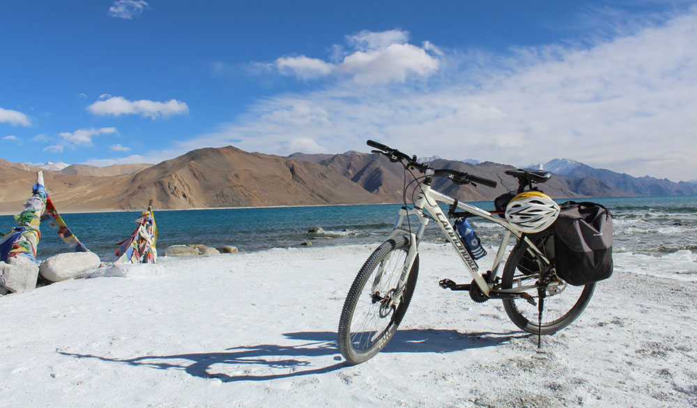
Motorcycles: 350cc+ highly recommended. Royal Enfield Himalayan, Hero XPulse 200T, KTM 390 Adventure are popular choices. Your bike must have:
- Good ground clearance (180mm+)
- All-terrain tires (CEAT Grip, MRF Revz)
- Reliable braking (prefer ABS)
- Comfortable suspension for rough terrain
- Luggage capacity for self-sufficiency
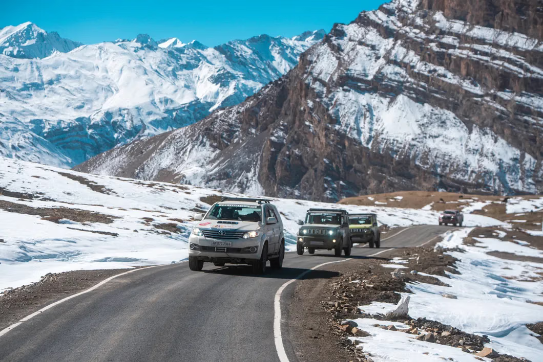
4-Wheelers: 4x4 essential. Thar, Scorpio, Fortuner, Innova Crysta work well. SUV must have:
- High ground clearance (200mm+)
- All-terrain or mud-terrain tires
- Low-range gearbox
- Spare tire (essential - sharp rocks common)
Fitness and Acclimatization
Wari La's elevation requires proper acclimatization:
- Minimum in Leh: 2-3 nights before attempting the pass
- Rest Day: Take it easy in Leh - drink water, avoid alcohol
- Diamox: Consider acetazolamide (consult doctor)
- Recognize AMS: Headache, nausea, shortness of breath. Descend immediately if symptoms worsen
Permits and Documentation
- Inner Line Permit (ILP): Required for Nubra Valley and Pangong Lake areas. Available in Leh.
- Vehicle Registration: Copy of RC
- ID Proof: Aadhaar, passport, or voter ID
- PAN Card: Some hotels require
- Passport-size Photos: 4-5 copies
What to Carry
Essential:
- Warm layers (thermals, fleece, down jacket) - temperatures drop below freezing
- Windproof and waterproof outer layers
- Good riding/walking boots
- Gloves (2 pairs - one warm, one waterproof)
- Balaclava or neck warmer
- Sunglasses with UV protection
- Sunscreen (SPF 50+)
- First aid kit with Diamox and basic medicines
- Oxygen cylinder (optional but recommended)
Vehicle Spares:
- Inner tubes (motorcycles) or puncture kit
- Basic tool kit
- Jumper cables
- Tow rope
- Extra fuel (carry 5-10 liters - no fuel stations after Hunder)
- Spare clutch/brake cables (motorcycles)
The Wari La Experience
The Ascent
The climb to Wari La begins gradually from Agham village, following a narrow valley carved by a glacial stream. The first 20 kilometers are relatively gentle as you gain altitude gradually, passing through a landscape of brown mountains and green valleys.
As you ascend, the vegetation thins and the terrain becomes more rugged. The road deteriorates - from dirt track to rocky path to barely recognizable trail in sections. The last 10 kilometers are the most challenging - steep gradients, hairpin bends, and loose gravel test your vehicle control and riding/driving skills.
The thinning air becomes noticeable - you'll need to stop more frequently to catch your breath and let your vehicle cool. The scenery, however, becomes increasingly spectacular with each kilometer gained. Glaciers appear on nearby peaks, turquoise lakes dot the valleys, and the vast expanse of the Ladakh range unfolds before you.
At the Summit
Reaching the Wari La summit is an achievement. At 5,312 meters, you're surrounded by snow-capped peaks stretching in every direction. A small cairn with prayer flags marks the top - the only sign of human presence in this desolate landscape.
Take your time here. The views are among the best in Ladakh. To the north, you can see the Karakoram range and the Siachen Glacier area. To the south, the Ladakh range dominates. Eastward, the vast Tibetan plateau stretches beyond the horizon. Westward, the Nubra Valley appears as a green ribbon in the brown mountains.
The summit is also one of the coldest places you'll experience, with wind chill often dropping temperatures to -10°C even in summer. Spend 15-20 minutes here - enough to appreciate the moment but not so long that you risk AMS from the prolonged exposure to extreme altitude.
The Descent
The eastern descent from Wari La is even steeper and more technical than the western ascent. The road follows a series of switchbacks down into the Shyok River valley. Gradient reaches 15-20% in sections - first gear, low range for vehicles.
The descent takes you through changing landscapes once again - from snow-covered scree slopes to barren rocky terrain to the first signs of vegetation as you approach the Shyok Valley. The road improves as you get lower, but remains challenging throughout.
After 3-4 hours of careful descent, you reach the Shyok River and the village of Tangtse. The sight of civilization after a day in the high mountains is welcome, and the relative luxury of a basic guesthouse feels like five-star accommodation.
Challenges and Risks
Altitude Sickness
At 5,312 meters, AMS is a real risk:
- Symptoms: Headache, nausea, dizziness, shortness of breath, insomnia
- Prevention: Proper acclimatization, stay hydrated, ascend gradually
- Action: If symptoms appear, descend immediately. Don't wait.
- Emergency: Carry oxygen. Know the locations of army posts that can help
Weather Extremes
Weather can change rapidly:
- Snow: Possible even in July. Can block the pass for hours or days
- Wind: Strong winds at the summit make riding/driving dangerous
- Fog: Sudden fog reduces visibility to near zero
- Temperature: Can drop from 15°C to -10°C in hours
Check weather before attempting. Turn back if conditions deteriorate.
Technical Challenges
- Steep Gradients: Up to 20% on descent. Test your brakes before attempting
- Loose Surface: Gravel and scree offer poor traction. Go slow, stay smooth
- Narrow Track: Barely wide enough for one vehicle in sections
- No Guard Rails: One mistake and it's a long fall
- Water Crossings: Glacial streams can be deep and fast-flowing
Complete Isolation
There's no phone connectivity and very little traffic. If something goes wrong:
- You're on your own - carry self-repair tools and know how to use them
- Army convoys pass occasionally - they're your best chance of assistance
- Inform someone of your route and expected return time
- Carry emergency rations and shelter
Accommodation and Facilities
Camping
Camping is the only option near the pass:
- Base Camp: Flat meadow below the summit. Stunning sunrise but very cold (-5°C at night)
- Shyok River: Several riverside camping spots. Warmer but more exposed
Carry all camping gear - tent, sleeping bag rated for -10°C, stove, food, water. Leave no trace - pack out everything you pack in.
Guesthouses and Homestays
Basic accommodations available in:
- Hunder (Nubra): Multiple guesthouses, ₹500-1500 per night
- Diskit: Larger village, more options, ₹800-2000 per night
- Tangtse: Basic guesthouses, ₹600-1200 per night
- Spangmik (Pangong): Several camps and guesthouses, ₹1000-2500 per night
Hot water is available but electricity is often limited to evening hours. Food is simple - dal, rice, vegetables, momos, thukpa.
Fuel and Supplies
- Last Fuel Station: Leh or Diskit (depending on route)
- Carry Extra: 5-10 liters for motorcycles, 20-30 liters for cars
- Supplies: Stock up in Leh or Diskit. Nothing available after Agham
- Water: Carry 5-10 liters. Glacial streams are drinkable with purification tablets
Combining Wari La with Other Ladakh Destinations
The Ultimate Ladakh Circuit
A popular itinerary combines all major Ladakh passes:
- Day 1-2: Arrive Leh, acclimatize
- Day 3-4: Leh to Nubra via Khardung La
- Day 5: Hunder to Wari La to Tangtse
- Day 6-7: Tangtse to Pangong Lake, stay overnight
- Day 8: Pangong to Leh via Chang La
Alternative: Nubra-Wari La-Nubra Circuit
For those wanting to focus on Wari La:
- Day 1-2: Leh acclimatization
- Day 3: Leh to Hunder via Khardung La
- Day 4: Hunder to Wari La and back (challenging full day)
- Day 5: Explore Nubra Valley (Diskit Monastery, Hunder sand dunes)
- Day 6: Return to Leh
Why Wari La is Worth It
After reading about the challenges, you might wonder: Is Wari La worth all the trouble? For adventure travelers, the answer is an emphatic yes. If you're interested in exploring more challenging passes, consider reading about Chang La Pass as well.
Wari La offers something that's increasingly rare in our interconnected world: genuine exploration. Standing on that pass, surrounded by peaks that few have seen, on a road less traveled, you experience the Himalayas as they've been for millennia - wild, untamed, and indifferent to human presence. The scenery is among the most spectacular in Ladakh, arguably superior to the more famous Khardung La.
The journey itself is transformative. The physical and mental challenges push your limits. The isolation forces self-reliance. The beauty overwhelms your senses. By the time you descend into the Shyok Valley, you've not just crossed a mountain pass - you've crossed a personal threshold.
Moreover, Wari La represents the future of Himalayan travel - not mass tourism, but carefully chosen adventures that respect both the environment and local communities. The pass challenges you to be a better traveler: more prepared, more respectful, more aware of your impact.
For motorcyclists, Wari La is a bucket-list ride - technical enough to be challenging, scenic enough to be unforgettable, remote enough to be an achievement. For drivers, it's the ultimate test of vehicle and skill. For adventure seekers of all types, it's an experience that defines what Himalayan travel should be.
In an era where even Ladakh's remotest corners are becoming accessible, Wari La remains one of the last true adventures in the region. Cross it, and you join a select group of travelers who've experienced the forbidden pass - an achievement worth every frozen breath and every rocky kilometer.
Location
Frequently Asked Questions
Q1.Where is Wari La Pass located?
Q2.How do I reach Wari La Pass?
Q3.When is Wari La Pass open?
Q4.Do I need permits for Wari La Pass?
Q5.Is Wari La Pass difficult to cross?
Q6.What is the best vehicle for Wari La Pass?
Q7.How long does it take to cross Wari La Pass?
Q8.Is altitude sickness a concern at Wari La Pass?
Recommended For You
Leh to Pangong Lake Bike Trip: Route, Distance & Tips
Leh to Pangong Lake bike trip guide with route, distance, Chang La crossing tips, permits, stay options, and practical safety planning for riders.
Spiti Valley Road Trip: The Ultimate Guide to Himalayan Adventure
Spiti Valley road trip guide: routes from Shimla/Manali, best time, permits, vehicles, itinerary, accommodation & tips for the ultimate Himalayan adventure.
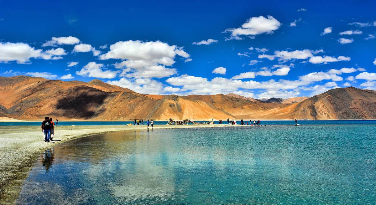
Pangong Lake Ladakh: Best Time, Permit Rules & Stay Options
Complete Pangong Lake guide: best time to visit, permits, how to reach from Leh, stay options & travel tips.
Never Miss an Adventure
Get the latest trekking guides, travel tips, and exclusive offers delivered straight to your inbox.