Umling La Pass Ladakh: World’s Highest Road, Height & Route
Rahul Garg
February 15, 2026
Plan Umling La Pass Ladakh with route details, altitude safety, permits, road condition updates, best season, and practical bike-trip preparation tips.
Introduction: Why Umling La Is Not a Regular Mountain Pass
Umling La Pass in Ladakh is globally known as one of the highest motorable roads on Earth, and for most travelers it represents the ultimate high-altitude road-trip milestone. This is not a casual viewpoint drive. It is a remote, weather-sensitive, low-oxygen route in eastern Ladakh where planning quality directly affects safety, comfort, and trip success.
The attraction is obvious: extreme elevation, raw Himalayan landscapes, military-road engineering, and a rare sense of achievement after a demanding ascent. But Umling La also carries serious constraints: permit requirements, very limited services, fuel planning, rapid weather shifts, and high risk of altitude-related discomfort if acclimatization is rushed.
This guide is built for practical execution. You will find route logic from Leh and Hanle, realistic time planning, seasonal windows, road-condition patterns, permits, acclimatization protocol, and emergency readiness tips for bikers and SUV travelers. If Umling La is on your Ladakh bucket list, treat this as a high-altitude mission plan, not just a sightseeing note.
About Umling La Pass: Height, Record, and Strategic Context
Umling La is located in eastern Ladakh near sensitive border sectors and is built and maintained through strategic road infrastructure efforts in harsh terrain. Widely quoted elevation figures place it around 19,000+ feet, and this extreme altitude is what makes the experience physically different from many mainstream Himalayan routes.
Why Umling La stands apart:
- Extreme elevation: oxygen availability drops sharply compared with lower passes.
- Remoteness: sparse settlements and minimal support services near the upper route.
- Road character: mixed high-altitude surfaces and weather-exposed stretches.
- Strategic location: access controls and permit discipline matter.
Many comparisons are made with Khardung La and Chang La. While those are iconic and demanding, Umling La generally feels more remote and physiologically harder due to sustained altitude exposure and route isolation.
Best Time to Visit Umling La
Season choice is critical. Even when roads are technically open, weather, wind chill, and surface conditions can shift rapidly.
Primary Travel Window
- July to September: usually the most practical period for most travelers.
- August: often considered more stable for road movement and visibility.
- Early October: possible in some years but with higher closure risk.
Periods to Avoid
- Winter and deep-snow months due to closure and severe exposure risk.
- Unstable transition periods without updated road confirmation.
Always verify current road status close to travel date. Do not rely on old videos or prior-year assumptions for a mission-grade route like Umling La.
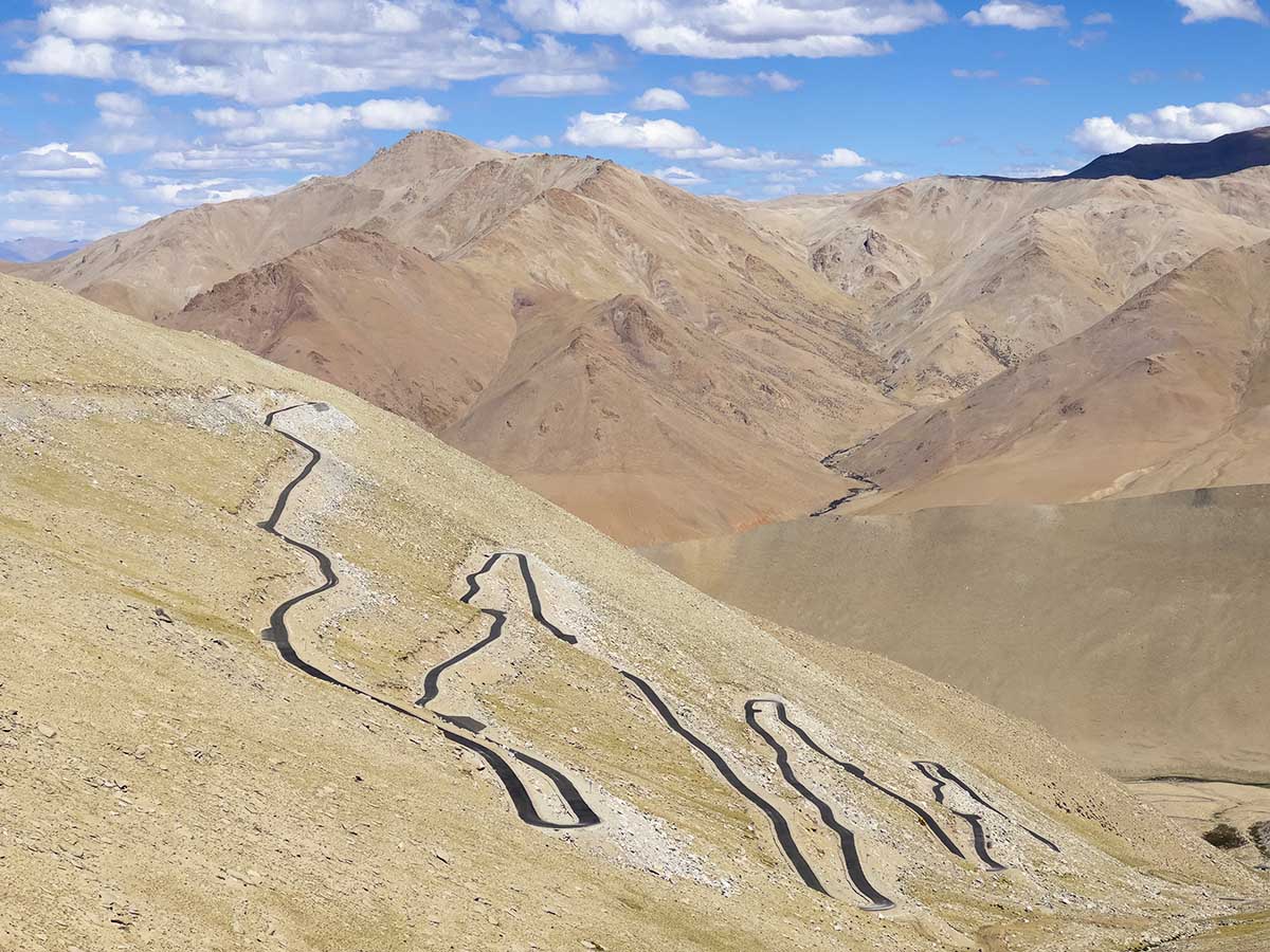
How to Reach Umling La: Route Framework
The most practical staging strategy is Leh acclimatization first, then Hanle base, then Umling La summit run. While map distances may look manageable, altitude and road texture significantly increase travel time.
Common Route Logic
Leh -> Upshi -> Chumathang -> Nyoma belt -> Hanle -> Umling La -> return Hanle/Leh
Popular planning pattern:
- Day 1: Leh acclimatization and paperwork checks.
- Day 2: Leh to Hanle with controlled pace.
- Day 3: Hanle to Umling La and return to Hanle.
- Day 4: Hanle to Leh or onward circuit.
This structure reduces fatigue and gives altitude adaptation time before summit push.
Required Internal Route References
These help compare pass difficulty and build route sequencing across Ladakh.
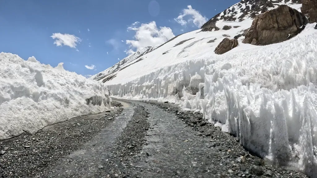
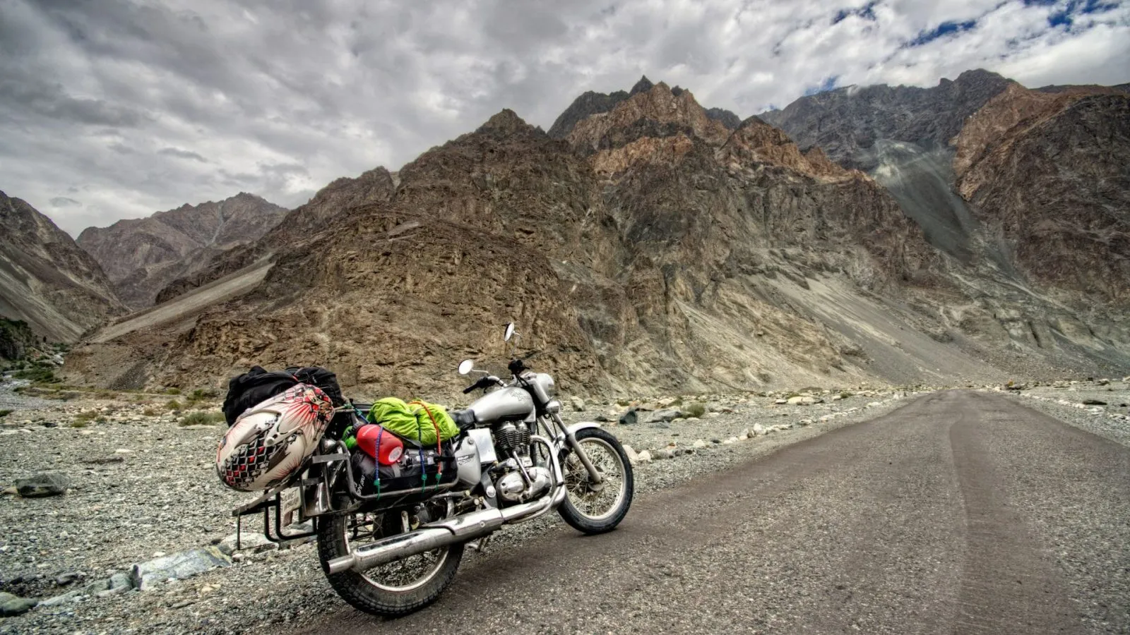
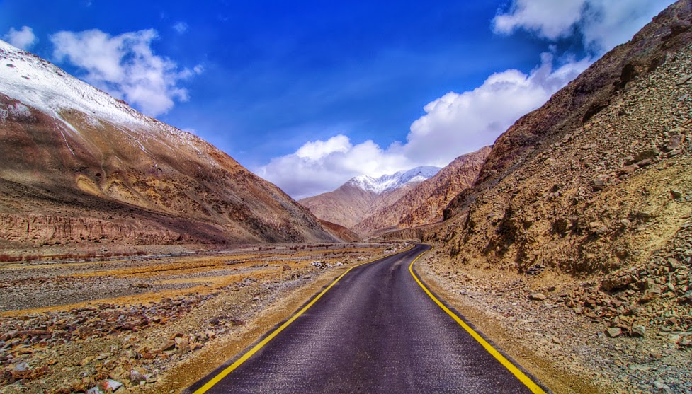
Road Conditions and Driving Challenges
Umling La road conditions vary by stretch and weather. Even when major sections are motorable, expect irregular patches, loose surfaces, and wind-exposed segments that demand full attention.
What to Expect on Ground
- Mixed tarmac and rough high-altitude road sections.
- Occasional loose gravel and washboard-like texture.
- Narrow portions where cautious overtaking is essential.
- Strong cold wind near upper approach zones.
- Very sparse mechanical support and no quick rescue comfort.
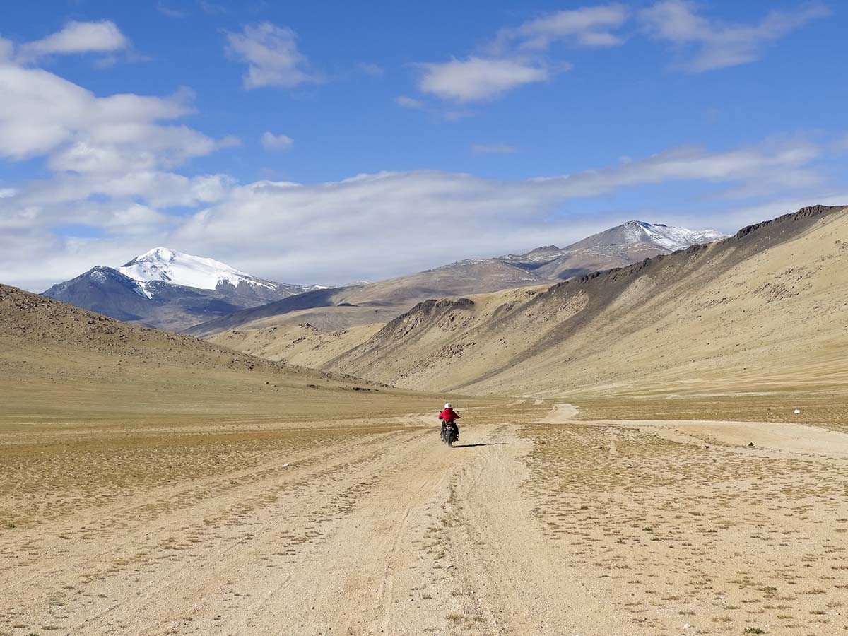
Vehicle Suitability
- Bikes: experienced high-altitude riders with reliable machines preferred.
- SUV: high-clearance vehicles improve confidence on rough patches.
- Fuel: top up early and carry reserve as per route plan.
For self-drive teams, one experienced mountain driver is strongly recommended. Overconfidence is a bigger risk factor than road complexity itself.
Acclimatization and AMS Safety: Non-Negotiable
This is the most important section of the trip. At Umling La altitude, even fit travelers can experience headache, nausea, fatigue, dizziness, or breathlessness if ascent is rushed.
Minimum Acclimatization Practice
- Spend at least 48 hours in Leh before pushing high routes.
- Avoid heavy exertion on first high-altitude days.
- Hydrate consistently throughout the trip.
- Sleep adequately before summit attempt.
On-Summit Behavior
- Do not stay longer than necessary at top in case of symptoms.
- Avoid sprinting, jumping, or overexertion for photos.
- If symptoms worsen, descend immediately.
Emergency Readiness
- Carry basic first-aid and personal medicines.
- Portable oxygen can be useful as backup but not a substitute for descent.
- Travel in convoy or with known support where possible.
- Share itinerary and checkpoint timing with contacts in Leh/Hanle.
Altitude illness is not a test of toughness. Fast descent is the safest response when symptoms escalate.
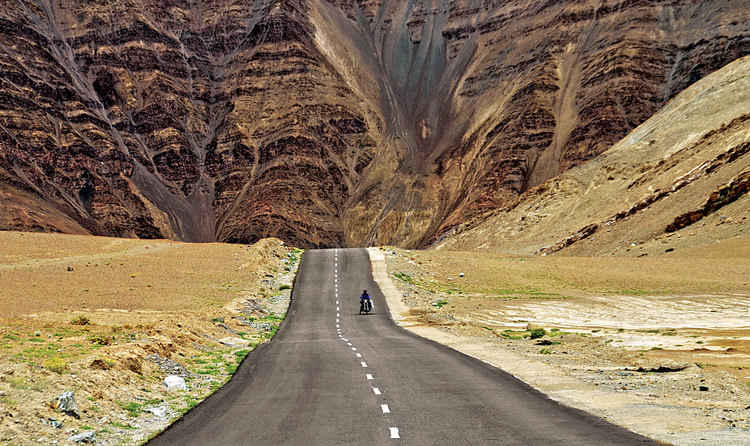
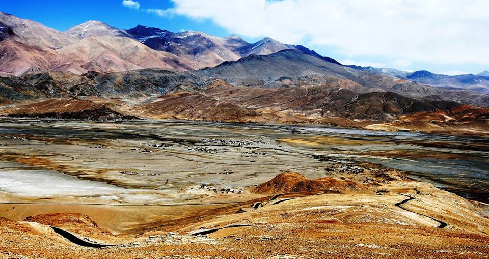
The Journey Experience: What Makes It Extraordinary
Beyond the record label, Umling La is a visual and emotional progression. As you leave settled zones, terrain turns increasingly raw: wide cold-desert expanses, minimal vegetation, distant ridgelines, and huge sky fields. Near the upper sections, silence and scale become the dominant experience.
The summit moment is often short but intense. You see the pass marker, capture the milestone photos, and feel the thin-air pressure immediately. The sense of accomplishment comes from preparation and discipline more than speed.
For many riders and drivers, the return leg feels as significant as the climb. Descending with caution, regaining oxygen comfort, and reaching Hanle safely is the actual completion of the Umling mission.
Permits and Documentation
Permit rules can evolve based on administrative and security requirements. Treat this as a live compliance step.
Typical Documentation Checklist
- Valid government photo ID.
- Inner-line/protected-area permissions as applicable.
- Vehicle papers and driving license.
- Multiple photocopies for checkpoints.
Always verify latest permit norms through Leh administration channels or authorized local operators before departure. Do this close to travel date, not weeks in advance only.
Fuel, Connectivity, and Logistics Reality
Umling La planning fails most often due to logistics underestimation, not lack of enthusiasm.
Fuel Strategy
- Refuel early at reliable points.
- Carry reserve fuel in approved containers where needed.
- Do not assume availability near remote sectors.
Connectivity
- Network can be weak or absent in segments.
- Keep offline maps downloaded.
- Share route plan before signal loss zones.
Food and Water
- Carry sufficient hydration and quick-energy food.
- Do not depend on frequent shops after remote transition points.
Simple preparedness here can prevent major stress at altitude.
Sample 4-Day Umling La Itinerary
Day 1: Leh Arrival + Acclimatization
- Hydration and light movement only.
- Permit confirmation and vehicle checks.
Day 2: Leh to Hanle
- Controlled pace with route breaks.
- Early arrival and rest in Hanle.
Day 3: Hanle to Umling La and Back
- Start early for stable weather window.
- Short summit halt and safe return.
Day 4: Hanle to Leh / onward Ladakh circuit
- Buffer for weather or fatigue adjustments.
This pacing is safer and more enjoyable than compressed 2-day aggressive attempts.
Travel Tips for First-Timers
- Do not compare your schedule with high-speed vlog itineraries.
- Build one extra buffer day for weather uncertainty.
- Keep gloves, layers, and windproof shell accessible.
- Start day early; afternoon conditions can deteriorate quickly.
- Respect military and checkpoint protocols fully.
- Prioritize team safety over summit-halt duration.
If this is your first extreme-altitude pass, going with an experienced Ladakh driver or organized group can significantly reduce risk.
Pre-Departure Expedition Checklist (Do This 48 Hours Before)
For Umling La, most failures happen before the trip starts: poor sleep, late permit confusion, weak fuel planning, and overconfident itinerary compression. Run a final checklist two days before summit day.
- Health readiness: no fever, no active respiratory issue, and stable acclimatization signs after Leh stay.
- Permit packet: printed copies in waterproof folder, plus phone backups.
- Vehicle check: brakes, tires, clutch response, coolant, battery, and lighting.
- Fuel readiness: base tank full plus planned reserve strategy.
- Layering kit: thermal base, fleece or mid-layer, windproof shell, gloves, neck cover.
- Food and hydration: quick-energy snacks, electrolyte mix, and enough water for entire route window.
- Emergency info: shared route schedule with at least one contact in Leh.
Set a hard turnaround rule before departure. If weather closes visibility, if a rider develops strong AMS symptoms, or if vehicle behavior is abnormal, abort summit and return safely. Reattempting later is always better than forcing a risky push at extreme altitude.
High-Altitude Decision Rules for Teams
If you are riding or driving in a group, define decision authority early. One experienced lead should call pace, halt duration, and abort triggers. Group split-ups in remote high-altitude sections create avoidable risk. Keep visual convoy discipline, predictable break points, and shared radio or phone protocol where possible. At Umling La altitude, teamwork is not optional logistics, it is a safety system.
Is Umling La Worth It?
Yes, for prepared travelers who value remote high-altitude roads and understand that the challenge is real. Umling La is not about ticking a location pin. It is about disciplined acclimatization, route planning, and respectful engagement with one of the toughest motorable terrains in India.
If you prepare well, this can become the most memorable road achievement of your Ladakh journey.
Final Takeaway
Umling La Pass Ladakh is a high-altitude mission, not a casual detour. Plan with season checks, permit clarity, Hanle staging, fuel reserve, and strict acclimatization. Drive slower than your map suggests and keep summit exposure short.
Done right, Umling La gives you one of the most powerful road-trip experiences in the Himalayas.
Keep flexibility, respect altitude, and prioritize safe return over summit linger time.
Location
Frequently Asked Questions
Q1.Where is Umling La Pass located?
Q2.What is the height of Umling La Pass?
Q3.Is Umling La the highest motorable road in the world?
Q4.How difficult is the road to Umling La?
Q5.Can we do Umling La by bike?
Q6.What is the best time to visit Umling La?
Q7.What permits are required for Umling La?
Q8.Is there oxygen at Umling La?
Recommended For You
Ladakh Road Trip Permits: Complete Guide (Online Apply)
Ladakh road trip permits guide covering online application, documents, route-wise access, fee components, and practical checkpoint rules.
Acute Mountain Sickness in Ladakh: Prevention
Complete guide to Acute Mountain Sickness in Ladakh. Learn symptoms, prevention, medicines, acclimatization tips & safety measures for high-altitude travel.
Hanle Village Ladakh: Stay Options, Route & Travel Essentials
Explore Hanle Village Ladakh with practical guidance on stargazing, permits, routes, monastery visits, weather, and remote-stay planning.
Never Miss an Adventure
Get the latest trekking guides, travel tips, and exclusive offers delivered straight to your inbox.