Shingo La Pass Ladakh: Route, Altitude & Trek Details
Ananya Sharma
November 15, 2025
Plan your Shingo La Pass Ladakh journey with route clarity, height details, best season, road status context, and practical safety tips for high-altitude travel.
Shingo La Pass Ladakh: Route, Height and Zanskar Trek Guide
Shingo La Pass (often also written as Shinkun La in recent infrastructure updates) is one of the most important high-altitude gateways connecting the Darcha side of Himachal with Zanskar-Ladakh routes. For trekkers, riders, and overland explorers, this pass is not just a viewpoint. It is a strategic and logistical corridor that has changed rapidly in the last few years because of road and tunnel development.
If you are planning the Darcha-Padum side journey, you need practical clarity: where Shingo La is located, how high it is, whether route conditions are road-based or trek-heavy in your travel window, what month is safest, and what level of acclimatization is required. This guide gives a current planning framework with route logic, difficulty level, packing strategy, and risk-aware travel tips.
Where Is Shingo La Pass and How High Is It?
Shingo La lies on the Darcha-Padum axis in the greater Himalaya, connecting Lahaul and Zanskar sectors. Altitude references vary slightly by source, usually around the 5,000-meter mark (roughly 16,500+ feet). These variations are normal in mountain documentation because measurement references may use different points near the pass crest.
| Location Detail | Commonly Used Reference | Why It Matters |
|---|---|---|
| Regional Position | Darcha to Padum/ Zanskar corridor | Defines access route and fuel planning |
| Altitude Band | Approx. 5,000+ meters | Requires proper acclimatization |
| Terrain Type | High pass, exposed mountain zone | Affects weather and crossing difficulty |
For travelers, practical altitude management is more important than one exact digit. The key is to treat this as a serious high-altitude crossing and plan conservatively.
Shingo La vs Shinkun La: Naming and Current Context
You will see both spellings in search results: Shingo La and Shinkun/Shinku La. In many travel narratives, Shingo La refers to the pass used in trekking and overland references. In recent national infrastructure news, Shinkun La is used for the tunnel project under this corridor.
Date clarity is important here. The Union Cabinet approval for the tunnel project came in February 2023. Subsequent reporting in 2024 and 2025 referenced project movement and updated completion estimates, with multiple public timelines mentioned across sources. As of 2026 planning, travelers should treat the corridor as actively evolving and verify current road opening status before departure.
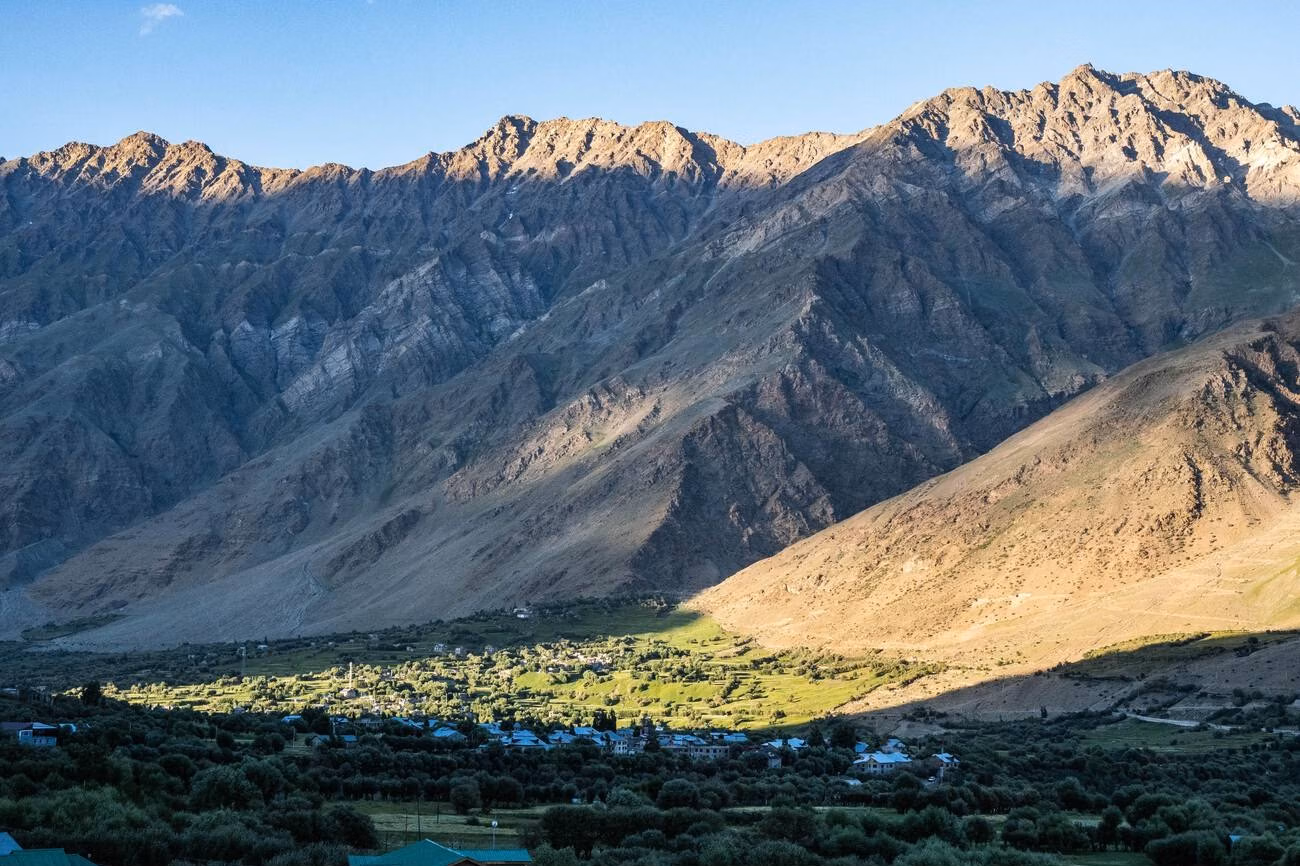
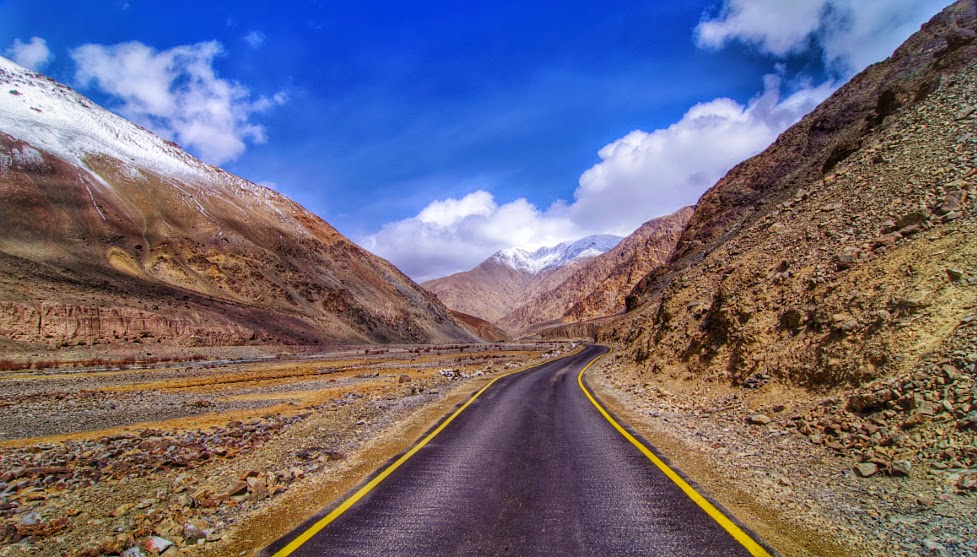
Darcha to Padum Route: Trek and Road Evolution
Historically, this crossing was a classic trek route linking Lahaul and Zanskar over multiple days. With road development, parts of what used to be purely trekking terrain have become accessible by vehicle in suitable season windows. That means route difficulty now depends heavily on your travel mode and the exact month.
- Trekking mode still requires endurance, altitude readiness, and weather awareness.
- Road mode reduces walking load but increases dependence on landslide and road-condition updates.
- Mixed itineraries (drive + short hikes) are increasingly common.
If your objective is expedition trekking, avoid assuming road access equals low difficulty. High-altitude stress and unpredictable weather remain core challenges.
Best Time to Cross Shingo La
The most practical travel window is typically July to September, when snow conditions and route openness are generally better than shoulder or winter months. Even in this window, local weather can shift quickly, and temporary closures can happen.
| Season | Typical Conditions | Planning Advice |
|---|---|---|
| Early Summer | Residual snow, variable crossings | Check route updates daily |
| Peak Summer | Most stable overland window | Best balance of access and safety |
| Autumn Shoulder | Clear views, colder nights | Carry stronger thermal gear |
| Winter | Heavy snow and closures likely | Not suitable for most travelers |
Before finalizing dates, combine this with best time to visit Ladakh and on-ground route intelligence.
Trek Difficulty and Physical Preparation
Shingo La routes are generally described as moderate-to-challenging, depending on itinerary format, pack weight, altitude response, and weather. The pass itself is not a technical climbing objective for standard trekkers, but altitude, long walking days, and terrain fatigue can make it demanding.
- Build cardio base for at least 4 to 6 weeks before the trip.
- Practice long-duration walking with load.
- Plan acclimatization in Leh/Keylong-side progression before aggressive movement.
- Carry altitude meds only under informed guidance.
For health preparedness, review acute mountain sickness in Ladakh before departure.
Route and Campsite Planning Basics
Older Darcha-Padum trek itineraries usually span around 8 to 11 days depending on stage length, acclimatization pace, and route variants. In current hybrid travel models, itinerary length may shorten if certain stretches are motorable, but weather and condition variability can still force delays.
| Planning Element | What to Consider | Risk if Ignored |
|---|---|---|
| Camp spacing | Altitude gain and water access | Fatigue and poor recovery |
| Weather buffer | At least 1 extra day in itinerary | Unsafe rushed movement |
| Food/fuel planning | Limited high-pass support | Supply shortfalls |
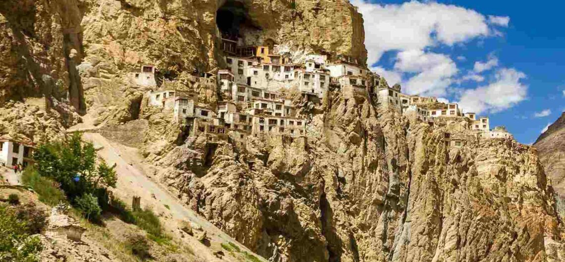
If you are extending the circuit, combine with Zanskar Valley and Phugtal Monastery Ladakh for stronger route continuity.
How to Reach Shingo La Starting Side
Most journeys approach from the Darcha side (via Manali-Keylong corridor) or through Zanskar route planning depending on trip direction. Access routes and permitted traffic can change by month and ongoing construction activity.
| Approach | Typical Use | Tip |
|---|---|---|
| Manali to Darcha side | Trek and overland start | Keep weather and landslide buffer |
| Zanskar to pass direction | Padum-linked circuit plans | Check latest road continuity status |
| Leh-side strategic circuit | Extended Ladakh route building | Plan fuel and permits early |
For larger context, reference road trip from Delhi to Leh Ladakh guide before locking final logistics.
Permits, Safety and Communication
Permit rules can vary by sector, nationality, and route inclusion. Travelers should not rely on old screenshots. Always confirm current permit requirements in your departure hub and carry printed copies where checkpoints still request physical documentation.
Mobile connectivity is unreliable in remote sections. Share route plans with a contact before departure and keep offline maps plus emergency essentials ready.
- Carry ID, permits, and backup photocopies.
- Use layered clothing for rapid weather shifts.
- Pack high-calorie snacks and hydration support.
- Avoid solo remote crossings without experience.
For permit guidance, use permits for Ladakh road trip.
Sample 3-Phase Planning Model
| Phase | Goal | Outcome |
|---|---|---|
| Phase 1 | Acclimatize and verify route status | Safer crossing readiness |
| Phase 2 | Cross Shingo La with daylight buffer | Reduced risk and better pace control |
| Phase 3 | Continue into Zanskar-linked destinations | Stronger journey value beyond single pass stop |
Common Mistakes to Avoid
The most common mistake is assuming all “open” route reports mean easy conditions. In high passes, open does not always mean comfortable or low-risk. Another issue is overpacking itinerary days without weather buffer. Mountain travel rewards conservative planning.
Travelers also confuse old trek-only descriptions with current mixed road-trek realities. Use updated local information before departure and keep flexible plans.
Final Take
Shingo La Pass Ladakh remains one of the most compelling gateway corridors into Zanskar, blending expedition feel with rapidly evolving infrastructure. Plan with current data, altitude discipline, and route flexibility. Done right, this crossing can be one of the strongest high-Himalayan experiences in your Ladakh journey.
Gear Checklist for Shingo La Crossing
Many Shingo La trips underperform not because of fitness but because of poor equipment choices. High-altitude weather can move from sun to freezing wind quickly, and inadequate layering causes early fatigue. Keep your kit simple, reliable, and weight-efficient.
- Base layer + fleece + windproof shell
- Insulated gloves, cap, UV sunglasses
- Waterproof trekking shoes with grip
- Trekking poles for descent stability
- Headlamp, power bank, offline navigation
- High-calorie snacks and electrolyte mix
- Compact first aid and blister care kit
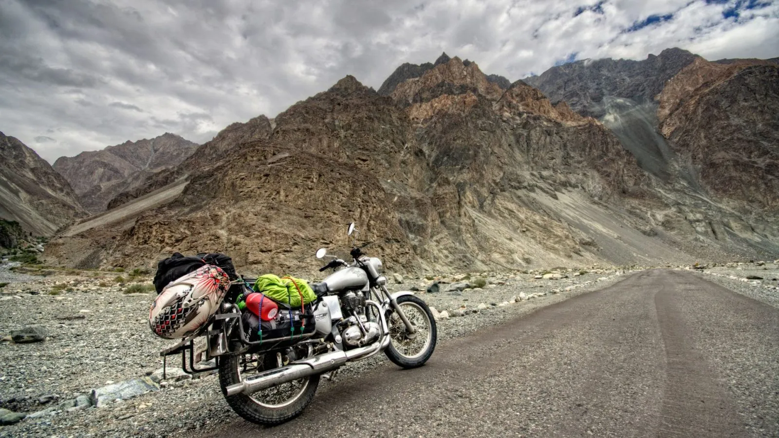
If you are on a bike-supported route, add spare fuel planning, puncture tools, and emergency thermal backup beyond standard road-trip kits.
Road Development Impact: What Travelers Should Expect
One of the biggest changes in this corridor is the transition from remote trek-first identity toward mixed mobility due to ongoing strategic road and tunnel development. This has practical benefits, but it also creates transition-phase uncertainty: temporary diversions, work zones, variable crossing windows, and inconsistent information across platforms.
For planning in 2026, the best method is to combine three sources: current local operator updates, district-level advisories where available, and recent traveler movement reports from the same week. Avoid making hard commitments based only on one social media post or one old itinerary blog.
| Planning Factor | Old Assumption | Current Reality |
|---|---|---|
| Route type | Trek-only mental model | Mixed road + trek depending on section and season |
| Timings | Fixed day count | Flexible timelines needed for weather/construction |
| Difficulty | Pure trekking stress | Still high-altitude demanding despite road progress |
Who Should Attempt Shingo La
Shingo La is best for travelers comfortable with uncertain mountain conditions, long days, and adaptive decision-making. It suits serious trekkers, experienced overland explorers, and photographers looking for raw high-Himalayan terrain. It is less suitable for first-time high-altitude travelers on rigid schedules.
If this is your first Ladakh trip, it is wiser to build experience through easier circuits first and then move to Shingo La with stronger acclimatization confidence and route knowledge.
Emergency Mindset and Decision Rules
In high mountain crossings, the most valuable skill is not speed but judgment. Set simple decision rules before departure:
- If weather drops sharply, halt and reassess instead of pushing summit timing.
- If one team member shows strong AMS symptoms, descend/stop early.
- If route data conflicts, prioritize local recent confirmation over old plans.
- If daylight margin is shrinking, do not force late risky movement.
These basic rules prevent most avoidable incidents in high-pass travel.
Location
Frequently Asked Questions
Q1.Where is Shingo La Pass located?
Q2.What is the height of Shingo La Pass?
Q3.How difficult is the Shingo La Pass trek?
Q4.How many days are needed for Darcha to Padum route planning?
Q5.Is Shingo La Pass open year-round?
Q6.Can vehicles cross Shingo La Pass?
Q7.What permits are needed for Shingo La sector travel?
Q8.What should I pack for Shingo La crossing?
Recommended For You
Ladakh Road Trip Permits: Complete Guide (Online Apply)
Ladakh road trip permits guide covering online application, documents, route-wise access, fee components, and practical checkpoint rules.
Best Time to Visit Ladakh: Season, Road Openings & Temperature
Find the best time to visit Ladakh with season-wise weather, road opening windows, monthly travel insights, and practical tips for road trips, trekking, and Chadar plans.
Phugtal Monastery Ladakh: Trek Route, Stay & Travel Planning
Complete trek guide to Phugtal Monastery in Ladakh. One of the oldest cave monasteries. Trek route, best time, homestay & tips.
Never Miss an Adventure
Get the latest trekking guides, travel tips, and exclusive offers delivered straight to your inbox.