Atal Tunnel Manali: Complete Guide to World's Highest Tunnel 2026
Ananya Sharma
February 19, 2026
Get a complete Atal Tunnel Manali guide with route details, timings, weather advice, and nearby places to explore.
Atal Tunnel Manali: Complete Travel Guide for First-Time Visitors
Atal Tunnel is one of the most important road infrastructure projects in the Indian Himalayas. For travelers, it is more than a drive-through attraction. It changes travel time, improves access to Lahaul side routes, and makes year-round movement more reliable than the older Rohtang-dependent journey. If you are planning Manali, Lahaul, or Leh-side road circuits, understanding this tunnel helps you plan safer and smarter itineraries.
This guide covers practical details: what to expect on the route, when to go, road behavior in mountain conditions, and how to combine Atal Tunnel with nearby destinations without rushing. For wider trip planning, connect this with the Manali travel guide and nearby route options like Rohtang Pass.
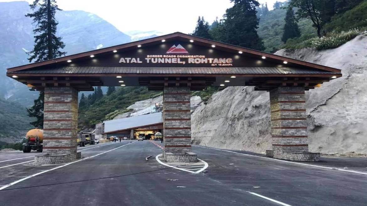
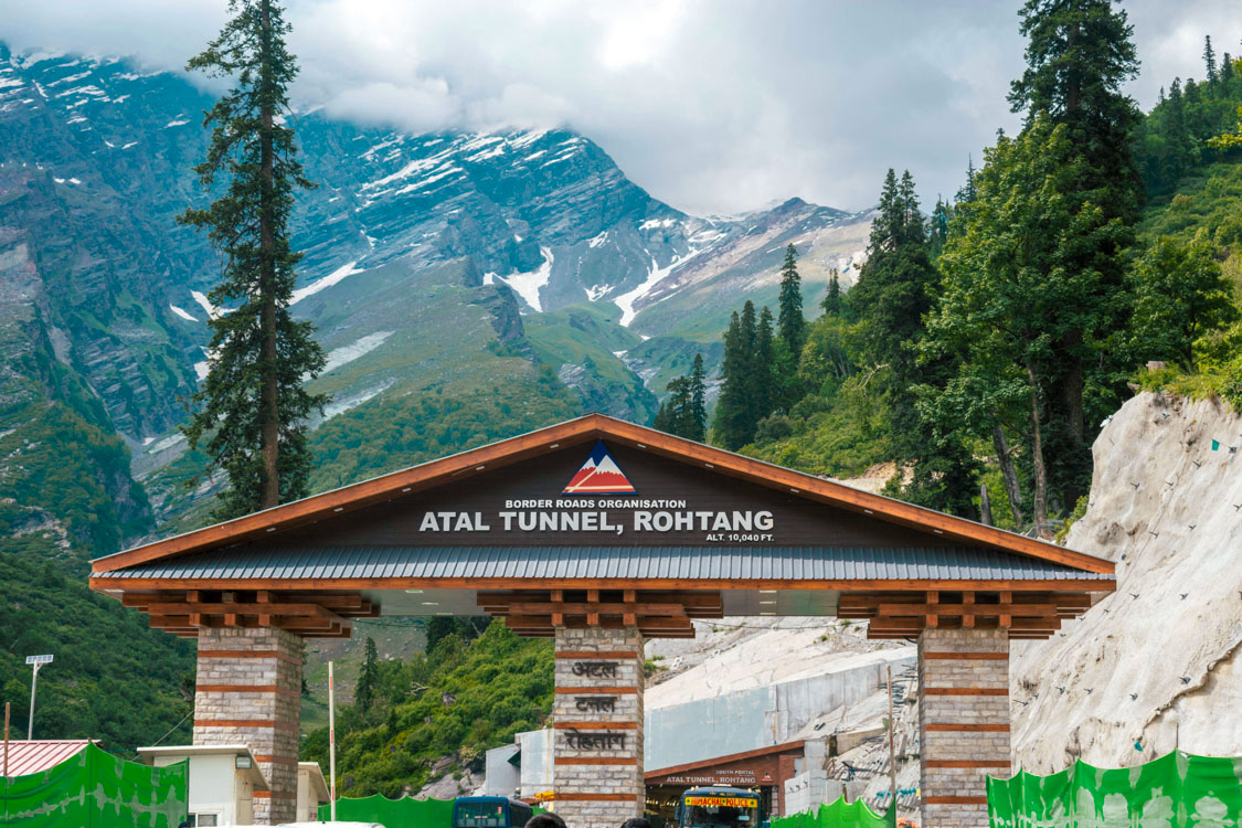
Why Atal Tunnel Matters
Atal Tunnel significantly reduces travel distance and time between Manali-side movement and Lahaul direction. Earlier, routes were heavily dependent on Rohtang Pass weather windows. Now, tunnel access provides more consistent connectivity for civilian traffic and strategic movement. This is why the tunnel is treated as both a tourism highlight and a national infrastructure milestone.
For regular travelers, the biggest advantage is predictability. You can plan day circuits with less uncertainty than old pass-only patterns, though mountain weather still matters. Road trips in Himachal always need flexibility, but the tunnel makes itinerary planning more practical for families and first-time visitors.
Tunnel Experience: What You Actually See
The experience is short but memorable if your expectations are realistic. Inside the tunnel, you move through a long, engineered corridor with controlled lighting, ventilation systems, safety infrastructure, and regulated traffic movement. This is not a sightseeing stop inside the tunnel; it is a transit segment where safe driving behavior is mandatory.
Most visual and photography opportunities are outside the tunnel approaches and nearby viewpoints. Plan short halts before or after crossing in designated safe spaces. Do not stop randomly or obstruct lanes for photos.
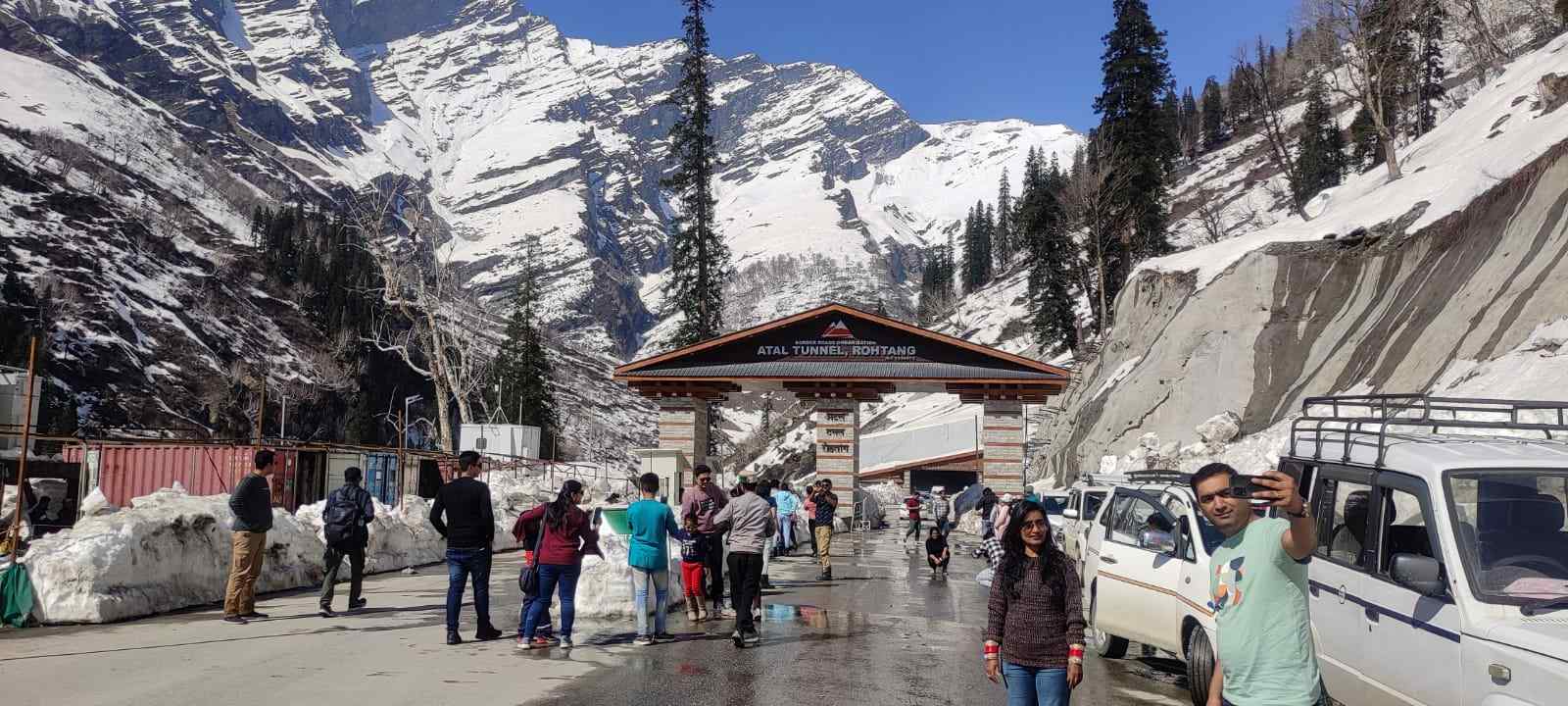
Best Time to Visit Atal Tunnel
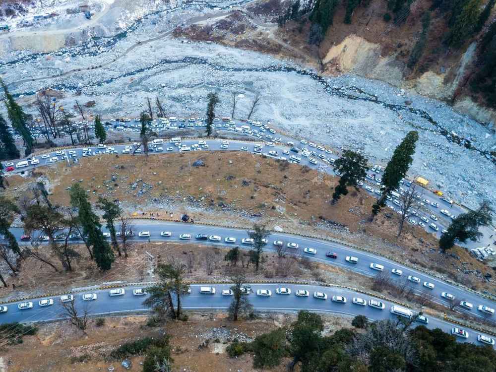
The most comfortable period for tourism is generally from spring through autumn, when road conditions and visibility are more stable. Winter attracts snow-focused travelers but also brings higher weather uncertainty and occasional traffic controls depending on active conditions. Monsoon and shoulder months can include landslide-sensitive stretches, so you must keep route checks active.
If you are traveling with children or senior family members, choose a clear-weather window and start early. Morning departures reduce traffic pressure and give more time for safe returns. Never overpack the day with too many mountain detours.
How to Reach and Plan the Route
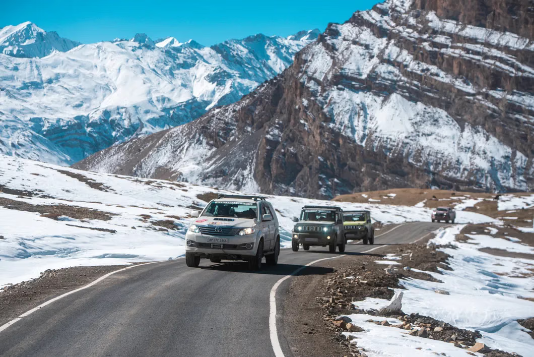
Manali is the most common base for a tunnel visit. You can do this as a half-day or full-day loop depending on where you stop after crossing. Private cab is usually the easiest option for first-timers. Self-drive is possible but requires mountain-driving confidence, especially in variable weather.
If you are combining nearby attractions, structure your route clearly: Manali departure, tunnel crossing, one or two planned stops, return before late evening. You can pair your day with local alternatives from places to visit in Manali or include a lighter cultural stop around Old Manali on the same or next day.
Driving Rules and Safety Essentials
Inside the tunnel, follow speed regulations, lane discipline, and no-stop rules strictly. Do not overtake unnecessarily. Keep headlights and indicators used responsibly according to current conditions and instructions. Avoid honking unless needed for safety. The tunnel is built for controlled movement; tourist-style driving behavior can create hazards quickly.
On approach roads, weather can change fast. Keep extra braking distance, avoid sharp acceleration, and stay alert on turns. If you are not confident in mountain roads, hire an experienced local driver rather than forcing a self-drive attempt.
Do You Need Permits?
Permit requirements can vary by route extension rather than by tunnel crossing alone. Standard tourist movement through the tunnel usually does not need special permit in normal conditions, but this can change based on administration, traffic regulation, weather, or onward destination rules. Always confirm latest local advisories before departure day.
If your plan extends toward sensitive or restricted areas, verify documentation in advance and carry hardcopy IDs. Keep offline copies of hotel and travel bookings because network consistency is not guaranteed everywhere.
Photography and Halt Planning
Best photography happens at safe designated points before and after the tunnel where you can capture mountain context, roads, and weather contrast. Inside-tunnel stopping for photos is unsafe and usually prohibited. Respect signage and avoid creating roadside congestion for quick social media captures.
If you want cleaner frames, travel in shoulder traffic windows and keep one dedicated photo halt instead of multiple random stops. This improves both safety and quality of results.
Food, Fuel, and Essentials
Always top up fuel before starting from your base. Carry water, quick snacks, a light medical kit, and weather layers even in pleasant months. Mountain routes can slow unexpectedly due to traffic, weather, or maintenance, and basic supplies prevent unnecessary stress.
Do not rely on uncertain en-route availability for all essentials. Keep cash backup along with digital payments. If you are traveling with kids, include extra warm layers and planned comfort breaks.
Suggested One-Day Tunnel Itinerary
8:00 AM: Depart Manali after breakfast.
9:30 AM: Reach tunnel approach and cross safely.
10:30 AM: Stop at one planned viewpoint.
12:30 PM: Lunch break at selected halt.
2:00 PM: Short local exploration on Lahaul side.
4:00 PM: Return drive toward Manali.
6:00 PM: Reach town before late-evening temperature drop.
This structure is practical for most first-time visitors and avoids risky late returns.
Common Mistakes to Avoid
Many travelers underestimate mountain timing. They start late, add extra detours, stop too often for photos, then rush return in poor light. Avoid this pattern. Keep your route limited and realistic. Another mistake is assuming road conditions remain the same all day. Always check updates before departure and again before return movement.
Avoid aggressive driving or copying unsafe behavior from other vehicles. Your priority is safe movement, not speed completion.
Atal Tunnel with Larger Himachal and Ladakh Plans
Atal Tunnel works best as a connector, not as a standalone full-day objective unless you are on a short trip. You can use it to structure longer road circuits and reduce route pressure. Travelers moving toward high-altitude circuits should still prepare thoroughly for acclimatization and route changes.
If you are extending toward Ladakh-side plans, combine with route preparation from Ladakh by road and keep weather-aware pacing. Good planning matters more than distance ambition in the Himalayas.
Travel Checkpoints Before Departure
Before starting, run a quick four-point check: road advisory, weather update, fuel level, and return-time discipline. This simple checklist prevents most avoidable issues on mountain routes. If you are traveling in peak season, also confirm expected traffic density and keep one optional backup stop in case your primary halt is overcrowded.
Families should keep one comfort buffer every 90 to 120 minutes, especially in colder months. Break planning reduces fatigue and keeps your driver alert through long return stretches.
Final Takeaway
Atal Tunnel is a major engineering achievement and a practical travel advantage for mountain road users. Visit it with correct expectations: safe transit, disciplined driving, and smart route planning. The destination becomes much more rewarding when you combine it with realistic timing and nearby experiences.
Plan early, drive responsibly, keep weather flexibility, and avoid itinerary overload. With this approach, your Atal Tunnel journey will be safe, smooth, and genuinely memorable.
Location
Frequently Asked Questions
Q1.What is special about Atal Tunnel?
Q2.Can we go through Atal Tunnel by private car?
Q3.What is the best time to visit Atal Tunnel?
Q4.Is Atal Tunnel open throughout the year?
Q5.How do I get permission to visit Atal Tunnel?
Q6.What is the length and altitude of Atal Tunnel?
Q7.Is photography allowed inside Atal Tunnel?
Q8.What safety features does Atal Tunnel have?
Recommended For You
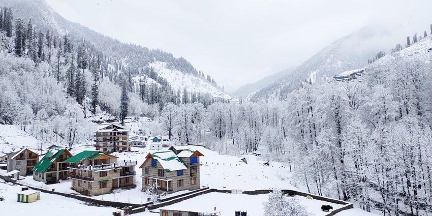
Snowfall in Manali: Best Time, Snow Points & Trip Planning
Experience snowfall in Manali! Guide to best time, weather updates, snow activities, travel tips & how to reach for white winter.
Spiti Valley Road Condition: Status
Latest practical guide to Spiti Valley road conditions with route-wise status, pass updates, monthly travel windows, and vehicle readiness tips.
Spiti Valley Road Trip: The Ultimate Guide to Himalayan Adventure
Spiti Valley road trip guide: routes from Shimla/Manali, best time, permits, vehicles, itinerary, accommodation & tips for the ultimate Himalayan adventure.
Never Miss an Adventure
Get the latest trekking guides, travel tips, and exclusive offers delivered straight to your inbox.