Kongka La Pass: Indo-China Border
Rohan Malhotra
December 20, 2025
Kongka La Pass in Ladakh: Discover the strategic Indo-China border pass, its military significance, disputed status, and why it remains inaccessible to tourists.
The Strategic Pass on the Indo-China Border
Kongka La Pass stands as one of the most strategically significant and controversial mountain passes in the Ladakh region. Located at an altitude of 5,171 meters (16,965 feet) above sea level, this pass serves as a critical point on the Line of Actual Control (LAC) between India and China. Unlike other famous passes in Ladakh that draw adventure seekers and tourists, Kongka La remains shrouded in military significance and restricted access, making it a subject of geopolitical interest rather than tourist exploration.
The pass derives its importance from its location in the disputed Aksai Chin region, an area controlled by China but claimed by India as part of Ladakh. Its strategic position has made it a focal point of the ongoing border dispute between the two nations, particularly following the 1962 Sino-Indian War. Unlike more accessible passes like Chang La, Kongka La remains firmly off-limits to civilians. Understanding Kongka La Pass requires delving into complex territorial claims, military history, and the delicate balance of power in the Himalayan region.
What sets Kongka La apart from other Himalayan passes is its complete inaccessibility to civilians. While travelers can freely visit Khardung La or Chang La with proper permits, Kongka La remains an active military zone where only authorized personnel are allowed. This restriction has created an aura of mystery around the pass, making it a subject of curiosity and speculation among those interested in Himalayan geopolitics.
Location & Geographic Significance
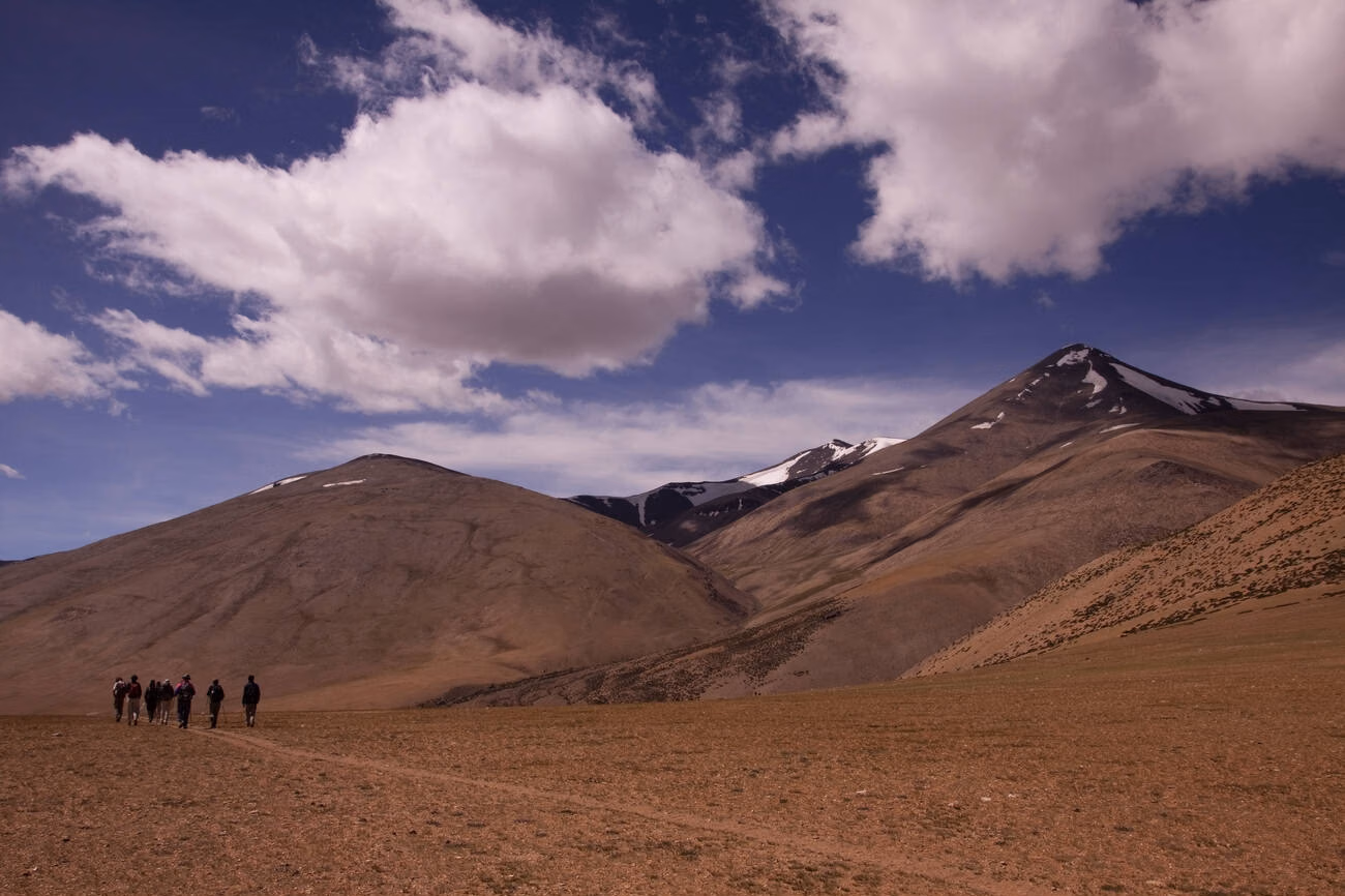
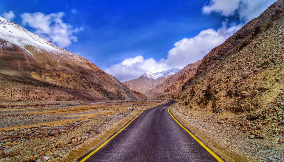
Kongka La Pass is situated in the easternmost part of Ladakh, forming part of the natural boundary between the Indian-controlled territory and the Chinese-administered Aksai Chin plateau. The pass lies approximately 120 kilometers southeast of Leh city, though actual access routes are heavily restricted. The coordinates place it in a remote region characterized by high-altitude desert terrain, with minimal vegetation and extremely harsh weather conditions.
The pass serves as a crucial gateway between the Changthang region of Ladakh and the Aksai Chin plateau. Its elevation of over 5,000 meters places it among the higher motorable passes in the region, though the exact road status remains classified due to its strategic nature. The surrounding terrain consists of rocky mountains, deep valleys, and plateaus that present natural challenges for military movement and logistics.
The climate in this region is extreme even by Ladakhi standards. Winter temperatures can drop below -40°C, while summer temperatures rarely exceed 10°C. The area experiences strong winds throughout the year, and snowfall can block access routes for extended periods. These harsh natural conditions add another layer of complexity to the military deployment and logistical operations in the region.
From a geographical perspective, Kongka La controls access routes between the Shyok river valley and the Aksai Chin plateau. Any movement of troops or supplies through this region would necessarily need to traverse this pass, making it a critical choke point in the military calculations of both nations. The pass's location also places it within proximity to other strategic locations like Pangong Tso Lake and the Galwan Valley, both of which have been flashpoints in recent border tensions.
Historical Background
The historical significance of Kongka La Pass cannot be understood without examining the broader context of the Sino-Indian border dispute. Prior to 1962, the boundaries in this region were poorly defined, with both India and China claiming different lines of control. The ancient trade routes that once connected Tibet with Ladakh passed through various mountain passes, though Kongka La's specific historical use remains less documented compared to more established routes like the Leh-Yarkand route.
The 1962 Sino-Indian War fundamentally changed the status of Kongka La and surrounding areas. China's military victory allowed it to establish control over Aksai Chin, including the strategic passes that provided access from Ladakh. Following the war, the Line of Actual Control (LAC) was established as a de facto border, though it remained undefined in many sectors, including the area around Kongka La.
Post-war developments saw China constructing extensive infrastructure in Aksai Chin, including roads and military installations. The controversial Xinjiang-Tibet highway, which passes through Aksai Chin, was a key Chinese project that required secure control over strategic passes like Kongka La. From the Chinese perspective, maintaining control over this region was essential for connecting Tibet with Xinjiang province.
For India, the loss of Aksai Chin and the strategic vulnerability it created became a major national security concern. The pass and surrounding areas became part of what India considers its sovereign territory, based on the alignment it proposed historically. This discrepancy in perceptions—China controlling Aksai Chin while India claiming it—has been the core of the dispute for over six decades.
Various diplomatic efforts have been made to resolve the boundary question, including confidence-building measures and bilateral agreements. However, the fundamental disagreement over Aksai Chin's status, and by extension Kongka La's position, remains unresolved. The 1993 and 1996 agreements on maintaining peace and tranquility along the LAC provided frameworks for managing the dispute, but did not address the core territorial claims.
Military Significance
The military importance of Kongka La Pass cannot be overstated. As a high-altitude pass on the LAC, it serves as a critical observation and defense point for both Indian and Chinese forces. The pass's elevation provides natural advantages for surveillance, allowing military positions to monitor movement across the border region effectively. Control over this pass translates to tactical advantages in the broader context of border defense.
For the Indian Army, Kongka La represents a forward position in the defense of eastern Ladakh. The pass's importance increased significantly following China's development of infrastructure in Aksai Chin. Indian military strategy focuses on monitoring Chinese movements through this sector and maintaining a credible deterrent presence. The nearby airbase at Leh and advanced landing grounds in eastern Ladakh form part of the broader military network that supports operations in this region.
From the Chinese perspective, Kongka La serves as a gateway between Tibet and Aksai Chin. The Chinese military maintains extensive infrastructure in the region, including roads, bunkers, and possibly radar installations. The pass forms part of China's defensive perimeter for Aksai Chin and provides depth to their positions along the LAC. Chinese military doctrine emphasizes holding territory and creating buffers, which makes strategic passes like Kongka La essential for their overall border security.
The pass also plays a role in the broader geopolitical contest between India and China. Both nations have invested heavily in developing border infrastructure, including roads, bridges, and tunnels to improve military mobility. In this context, Kongka La is not just a local tactical position but part of a larger strategic chessboard. The ability to quickly move troops and supplies through this sector could be crucial in any future conflict scenario.
Surveillance and monitoring systems deployed around Kongka La include advanced radar, thermal imaging, and possibly satellite communication equipment. The pass's location makes it ideal for monitoring deep into the other side's territory, providing early warning capabilities. Both sides maintain regular patrols in the area, though these are often conducted with great caution to avoid escalation.
The Line of Actual Control Context
Understanding Kongka La requires understanding the concept of the Line of Actual Control. The LAC is not a formally agreed international boundary but rather the line up to which each side exercises actual control. In the Kongka La sector, the LAC roughly corresponds to the ceasefire line of 1962, though perceptions about its exact alignment often differ between India and China.
This disagreement about where exactly the LAC runs creates situations where both sides claim the same territory as their own. Such differing perceptions have led to standoffs and confrontations in the past, as patrols from both sides occasionally encounter each other in areas where claims overlap. The mechanisms for managing such situations have evolved over the years, including hotlines between local commanders and established protocols for disengagement.
The Disputed Territory Status
The disputed nature of Kongka La Pass stems from the broader dispute over Aksai Chin. India claims Aksai Chin as part of its Ladakh region, based on historical boundaries and traditional usage. China, on the other hand, considers Aksai Chin as part of its Xinjiang and Tibet autonomous regions, citing historical connections and the need for strategic depth.
This territorial dispute is not merely about lines on a map but involves significant strategic considerations. For India, Aksai Chin's loss created a vulnerability in Ladakh's eastern approaches and removed a traditional buffer between Ladakh and Tibet. The Chinese control over this region also brings Chinese military infrastructure closer to India's strategic interests in the Himalayas.
For China, Aksai Chin serves as a critical connector between Tibet and Xinjiang. The region's sparse population and harsh terrain made it easier for China to establish control following the 1962 war. The investment in infrastructure, particularly the Xinjiang-Tibet highway, demonstrates China's long-term commitment to maintaining this connection.
The international perspective on this dispute has been relatively muted. Major powers have generally avoided taking explicit positions on the merits of India's and China's claims, preferring to encourage peaceful resolution through bilateral dialogue. This approach leaves the dispute essentially to be managed by the two parties directly involved.
Within India, the loss of Aksai Chin remains a sensitive issue, particularly within military and strategic circles. The pass and surrounding areas are seen as occupied territory that must eventually be restored to Indian control. This perspective influences India's military posture and diplomatic approach to the border question.
Why Tourists Cannot Visit Kongka La
Unlike other famous passes in Ladakh such as Khardung La, Chang La, or even the strategic Zoji La, Kongka La remains completely off-limits to civilians. This restriction is absolute and non-negotiable, stemming from several critical factors that make tourist access impossible in the current security environment.
Active Military Zone: The primary reason for prohibiting civilian access is the active military nature of the area. Kongka La and surrounding regions house sensitive military installations, forward positions, and infrastructure whose secrecy and security are paramount for national defense. The presence of troops, weapons systems, and surveillance equipment makes these areas unsuitable and unsafe for civilian presence.
No Permit System: Unlike other restricted areas in Ladakh where tourists can obtain Inner Line Permits or Protected Area Permits, Kongka La has no such provision. The Indian government does not issue any permits for civilian travel to this region, reflecting its status as an exclusively military zone. Even researchers, journalists, and documentary makers are generally denied access without special clearance from the highest levels.
Border Sensitivity: Given the disputed nature of the border and ongoing tensions between India and China, allowing tourists near Kongka La could create complications. Civilian presence near forward positions could be misunderstood by the other side, potentially leading to unintended escalation. Moreover, tourists could inadvertently compromise military operations or security arrangements through photography or casual conversation.
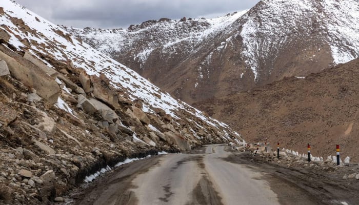
Physical Access Challenges: Even if permits were theoretically available, reaching Kongka La would be extremely difficult. The roads leading to the pass, if they exist at all in a conventional sense, are military roads maintained for logistical purposes. There is no public transportation, no tourist infrastructure, and no support services of any kind. The area is essentially a forward military outpost, not a tourist destination.
Safety Considerations: The extreme altitude, harsh weather, and complete absence of rescue or support services make it dangerous for unaccompanied civilians to visit. The military presence itself does not extend to providing rescue or assistance to civilians in distress. In case of medical emergencies or accidents, evacuation would be extremely challenging.
It's important for travelers to understand that this restriction is not flexible. Unlike other restricted areas where special permissions might occasionally be granted for research or specific purposes, Kongka La remains firmly closed. Attempting to visit without authorization would result in immediate detention and potential legal consequences, besides the physical dangers involved.
Nearby Accessible Areas
While Kongka La itself remains inaccessible, several nearby areas offer travelers the opportunity to experience the beauty and strategic significance of eastern Ladakh. These locations, though distant from the actual pass, provide insights into the region's geography and the broader context of India's border defenses.
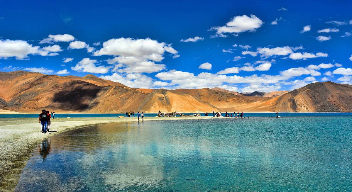
Pangong Tso Lake: Perhaps the most famous accessible attraction in eastern Ladakh, Pangong Tso lies approximately 150 kilometers west of Kongka La. The lake is one of the most stunning lakes in Ladakh, with azure waters spanning 134 kilometers, approximately one-third falling in Indian territory and the remainder in Chinese-controlled Tibet. The lake is accessible by road from Leh, and Inner Line Permits are readily available for Indian citizens. Pangong Tso offers spectacular scenery and the opportunity to see the Line of Actual Control from a distance, as the lake itself is divided by the LAC.
Spangmik Village: Located on the banks of Pangong Tso, Spangmik is one of the farthest points that civilians can visit in this sector. The village offers basic homestay accommodation and provides stunning views of the lake and surrounding mountains. From Spangmik, visitors can see the mountains that mark the LAC and appreciate the strategic geography of the region. The village also houses a small ITBP (Indo-Tibetan Border Police) post.
Chushul Sector: The Chushul valley, located south of Pangong Tso, has historical significance from the 1962 war and offers limited access to civilians. The area requires special permissions beyond regular Inner Line Permits, as it houses military facilities. However, determined travelers can sometimes arrange visits through proper channels, particularly to pay respects at the Rezang La Memorial, commemorating the brave soldiers of the 13th Kumaon Regiment who fought here during the 1962 conflict.
Hanle Village: Though not directly near Kongka La, Hanle in the Changthang region represents one of the easternmost accessible points in Ladakh. The village is home to the Hanle Observatory and an ancient monastery. Hanle requires Inner Line Permits but is readily accessible to tourists. Hanle requires Inner Line Permits but is readily accessible to tourists. The journey to Hanle takes visitors through some of Ladakh's most remote and beautiful landscapes, offering a glimpse of life near the borders.
Tsaga, Loma, and Nyoma: These villages in eastern Ladakh are accessible with permits and provide opportunities to see the Changthang region's unique culture and landscape. The area is known for its nomadic Changpa herdsmen, rare wildlife including kiangs (wild asses) and black-necked cranes, and high-altitude desert scenery. For those interested in exploring more of Ladakh's remote regions, visiting the Dha Village offers insights into the unique Aryan valley culture. While these locations are still far from Kongka La, they represent the frontier of tourist-accessible Ladakh.
When visiting these border areas, tourists must remember that photography restrictions may apply, especially near military installations. It's essential to respect local rules and the sensitivities of being in a border region. The ITBP and army personnel deployed in these areas are professional and courteous but expect visitors to follow guidelines.
Current Status & Strategic Developments
The current status of Kongka La Pass and surrounding areas reflects the ongoing strategic competition between India and China. Following the deadly clashes in Galwan Valley in 2020 and subsequent standoffs at various points along the LAC, eastern Ladakh has witnessed significant military buildup on both sides. This development has reinforced Kongka La's importance as part of the broader defensive architecture.
India has accelerated infrastructure development in border areas, including road construction, bridge building, and the creation of additional forward locations. The all-weather road to Daulat Beg Oldi (DBO) and the opening of the strategically important Zoji La tunnel are part of this broader infrastructure push. While these developments are not directly at Kongka La, they enhance India's overall capability to project force and sustain troops in the eastern Ladakh sector.
China, for its part, has continued to develop extensive infrastructure in Aksai Chin, including additional military positions, roads, and possibly air defense systems. Satellite imagery has shown significant construction activity on the Chinese side of the LAC in this sector. These developments indicate China's long-term commitment to maintaining control over Aksai Chin and its approaches.
Diplomatically, both nations have engaged in multiple rounds of military commander-level talks to resolve standoffs and establish protocols for disengagement. The 2020-21 crisis led to the creation of buffer zones in certain areas, though the specifics of each sector's arrangements vary. The situation around Kongka La remains tense but stable, with both sides maintaining forward positions while working to prevent accidental escalation.
The broader geopolitical context, including India's growing strategic partnership with the United States and China's expanding global influence, adds complexity to the border issue. However, both nations have demonstrated a preference for managing the dispute through bilateral mechanisms rather than allowing it to derail the overall relationship.
For the foreseeable future, Kongka La Pass will remain a strategic military location with no prospect of civilian access. The pass's importance is likely to grow rather than diminish, as both India and China continue to strengthen their border infrastructure and military capabilities. Travelers interested in this region will need to content themselves with visiting accessible areas in eastern Ladakh and appreciating the unique landscape and culture from a distance.
Understanding the Border Dynamics
For those interested in the complexities of the Indo-China border, it's worth understanding that the situation around Kongka La is part of a larger pattern. The LAC is divided into three sectors: western (Ladakh), middle (Himachal Pradesh and Uttarakhand), and eastern (Sikkim and Arunachal Pradesh). Each sector has its own dynamics, with the western sector, where Kongka La is located, being particularly contested.
The border management mechanisms that have evolved include regular meetings between local commanders, flag meetings to address specific issues, and established protocols for patrol encounters. These mechanisms have helped prevent minor incidents from escalating, though they have not resolved the underlying territorial dispute.
Travelers visiting Ladakh should be aware that the region they are exploring is not just a beautiful tourist destination but a strategic frontier where national security interests are paramount. This awareness adds depth to the travel experience and fosters greater appreciation for the challenges of maintaining peace in such remote and difficult terrain.
While Kongka La Pass itself will remain out of bounds for civilians, the accessible regions of eastern Ladakh offer profound experiences that combine natural beauty, cultural richness, and glimpses into the strategic realities of India's frontiers. Responsible tourism that respects local sensitivities and security considerations can contribute positively to the region while allowing visitors to appreciate its unique character.
Location
Frequently Asked Questions
Q1.Where is Kongka La Pass located?
Q2.Can civilians visit Kongka La Pass?
Q3.What is the altitude of Kongka La Pass?
Q4.Why is Kongka La Pass strategically important?
Q5.Which countries claim Kongka La Pass?
Q6.Is there an Indian army post at Kongka La?
Q7.What are the nearest tourist attractions?
Q8.Are there any restricted areas nearby?
Recommended For You
Pangong Lake Ladakh: Best Time, Permit Rules & Stay Options
Complete Pangong Lake guide: best time to visit, permits, how to reach from Leh, stay options & travel tips.
Best Time to Visit Ladakh: Season, Road Openings & Temperature
Find the best time to visit Ladakh with season-wise weather, road opening windows, monthly travel insights, and practical tips for road trips, trekking, and Chadar plans.
Mountain Passes in Ladakh: Heights, Routes and Tips
Complete guide to mountain passes in Ladakh with key routes, heights, road status planning, permits, AMS safety, and practical driving tips.
Never Miss an Adventure
Get the latest trekking guides, travel tips, and exclusive offers delivered straight to your inbox.