Mountain Passes in Ladakh: Heights, Routes and Tips
Ananya Sharma
December 8, 2025
Complete guide to mountain passes in Ladakh with key routes, heights, road status planning, permits, AMS safety, and practical driving tips.
Introduction: Why Mountain Passes Define Every Ladakh Journey
Any road trip in Ladakh is ultimately a pass-to-pass journey. Valleys, lakes, monasteries, and villages are all connected through high-altitude crossings that control weather exposure, travel time, and route safety. That is why understanding mountain passes in Ladakh is more important than just collecting destination names. A pass can decide whether you reach your next halt comfortably or struggle with fatigue, road closure, or altitude stress.
Most first-time travelers focus on famous names such as Khardung La or Chang La, but the full Ladakh road system includes multiple major and minor passes across Leh-Nubra, Leh-Pangong, Leh-Kargil, and Manali-Leh corridors. Each pass has a different altitude profile, road character, opening pattern, and risk window. A strong itinerary is built by sequence: acclimatize, cross medium-altitude routes first, and keep extreme passes after your body adjusts.
This guide covers the major passes, approximate heights, route context, vehicle and permit planning, and practical safety protocols for high-altitude driving. For trip sequencing, combine this with Delhi to Leh Ladakh road trip guide and Ladakh permits guide.
1. Khardung La Pass
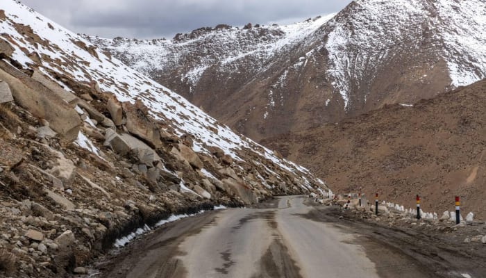
Khardung La Pass is one of the most famous high-altitude crossings in Ladakh and a key route toward Nubra Valley. It is widely marketed as a bucket-list drive, but the practical reality is that road condition and weather matter more than popularity. On busy days, traffic and roadwork can slow movement significantly.
Why Khardung La Matters
- Primary gateway between Leh and Nubra sectors.
- High-altitude acclimatization test for first-time travelers.
- Strong snow-wall visuals in shoulder and winter windows.
- High tourist load, so planning start time is critical.
Start early from Leh, avoid long idle exposure at the top, and descend steadily. For most travelers, this pass should be attempted only after at least one acclimatization day in Leh.
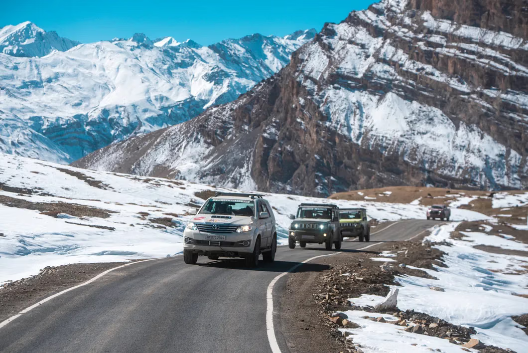
2. Chang La Pass
Chang La Pass usually appears on the Leh to Pangong route and is one of the most crossed high points in typical Ladakh itineraries. The approach includes steep segments, unpredictable weather pockets, and occasional rough sections depending recent maintenance.
Chang La is often underestimated because it is included in popular tourist circuits. But altitude exposure remains serious, especially for travelers attempting Pangong soon after reaching Leh. Keep hydration steady, avoid overexertion at the top, and carry warm layers even in summer months.
- Route role: major crossing in Leh-Pangong travel.
- Risk factor: AMS symptoms can appear with rushed ascent.
- Practical tip: keep short halt at top, prioritize smooth descent.
3. Zoji La Pass
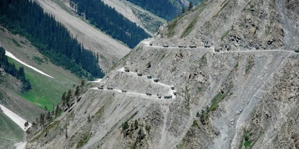
Zoji La Pass connects Kashmir-side access with Ladakh approach corridors and has historically been one of the most weather-sensitive gateways into the region. It is known for narrow stretches, changing road conditions, and critical strategic significance. Seasonal opening and closure patterns strongly affect overland planning from Srinagar side.
When open, Zoji La enables a dramatic transition from greener Kashmir landscapes to the harsher mountain profile of Ladakh. When weather turns, movement can become unpredictable. Always verify latest corridor updates before committing intercity transfer dates.
| Pass | Main Route Function | Typical Planning Priority |
|---|---|---|
| Khardung La | Leh to Nubra connection | High |
| Chang La | Leh to Pangong access | High |
| Zoji La | Kashmir to Ladakh gateway | Critical for Srinagar entry plans |
| Taglang La | Leh-Manali highway high point | High for overland circuits |
4. Taglang La Pass
Taglang La is a major high point on the Leh-Manali axis and a key marker in long-distance overland journeys. It is often crossed in itineraries that combine Leh with Sarchu, Jispa, or Manali-side exits. Because of long driving hours on these circuits, fatigue can be as dangerous as altitude.
Even experienced riders and drivers should avoid aggressive schedules on this stretch. Keep one realistic halt before and after major pass-crossing days. If weather shifts or roadwork delays movement, accept schedule slippage instead of forcing night driving on unknown mountain roads.
5. Umling La Pass
Umling La Pass is one of the most extreme high-altitude motorable routes in Ladakh and is usually attempted by experienced overland travelers with careful logistics. It is located in a highly remote sector where route planning, permits, and vehicle reliability become non-negotiable. Conditions can be harsh and support services are limited.
Because highest-road claims in the Himalaya can change when new roads open, travelers should treat altitude superlatives carefully and focus on practical safety rather than label chasing. In late 2025, the Border Roads Organisation reported a higher motorable axis near Mig La in eastern Ladakh, which means historic ranking claims can shift over time.
- Core challenge: altitude plus remoteness, not just road gradient.
- Best approach: only after proper acclimatization and permit readiness.
- Vehicle rule: no compromise on mechanical condition.
6. Fotu La Pass
Fotu La is an important crossing on the Leh-Kargil-Srinagar highway side and often appears in itineraries heading toward Lamayuru and Kargil. Compared with extreme high-altitude routes, it is usually more manageable, but mountain weather and traffic still demand disciplined driving.
This pass is useful for travelers who want a broader understanding of Ladakh beyond Nubra and Pangong sectors. If you are designing a complete regional loop, include Fotu La and nearby heritage stops rather than staying only on mainstream tourist corridors.
7. Lachulung La Pass
Lachulung La appears in the high-route chain of the Leh-Manali road network. It is frequently crossed along with neighboring passes during long transit days. While not as publicized as Khardung La, it contributes significantly to altitude load on travelers moving between multiple high points in one day.
On multi-pass days, hydration, oxygen adaptation, and disciplined pace become critical. Keep meal breaks light, avoid high exertion during short halts, and watch for early AMS signs such as headache, nausea, and breath discomfort.
8. Nakee La Pass
Nakee La is another key crossing in the Leh-Manali high-altitude chain. Usually paired with Gata Loops region movement, it is part of route segments where road geometry, wind exposure, and weather can affect driving rhythm. Travelers often underestimate cumulative strain when crossing several passes in sequence.
The safest method is simple: cross early, keep breaks controlled, and avoid pushing to reach distant night halts if daylight or weather margin drops.
9. Other Important Passes in Greater Ladakh Circuits
Depending your route, you may also encounter or plan around additional passes such as Wari La and Shingo La. These are less mainstream than Khardung or Chang La but highly relevant in advanced road itineraries.
- Wari La Pass for alternative high-route travel logic.
- Shingo La Pass in broader high-Himalaya expedition style circuits.
- Kongka La and other restricted-border references, which are not standard tourist road drives.
For most first-timers, it is better to complete one stable classic circuit than chase every high pass in one trip.
10. Road Conditions and Pass Status: What Actually Changes
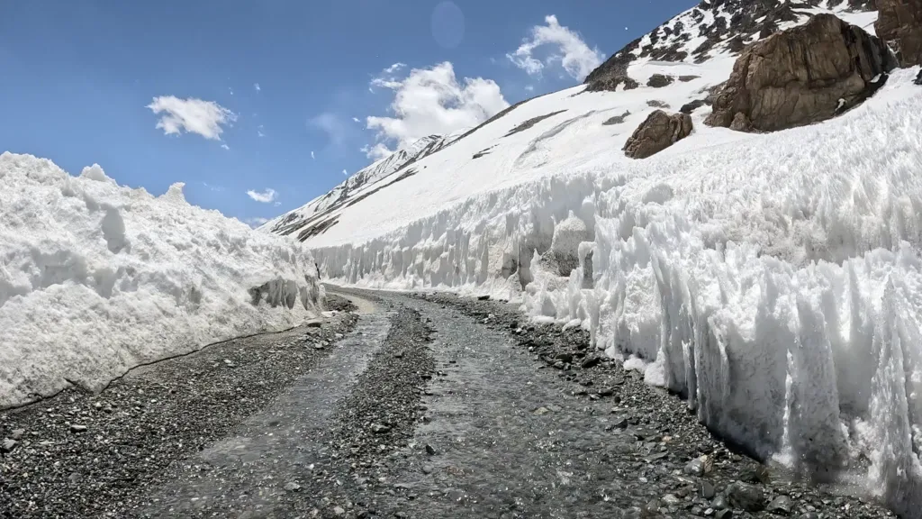
Ladakh pass status is dynamic. Even when a route is officially open, local conditions can include slush, black ice, rockfall patches, controlled traffic windows, or temporary closures for roadwork and military movement. Never assume a pass is fully smooth because it opened a week earlier.
Common Variables That Affect Pass Crossings
- Fresh snowfall and wind drift at higher points.
- Night freeze followed by morning black ice.
- BRO maintenance and convoy management.
- Tourist-season congestion at iconic pass markers.
- Landslide or falling-rock risk after rain events.
Use local taxi unions, hotel hosts, and same-day driver networks for route intelligence. This is usually more reliable than old social-media updates.
11. Permit Requirements for Ladakh Passes
Not every pass requires the same permit type, but many routes in Ladakh involve regulated sectors. Domestic and foreign travelers can face different access rules depending zone sensitivity and current policy. Always complete permit checks before vehicle departure, not at the checkpoint moment.
Use permits for Ladakh road trip for detailed document planning. Keep both digital and printed copies where possible, and carry valid ID at all times.
12. Best Time to Cross Mountain Passes in Ladakh
For most travelers, late spring to early autumn offers the most practical balance between road access and weather stability. But each month has tradeoffs.
- May to June: opening-season excitement, variable residual snow, mixed road quality.
- July to August: broader route access, but traffic-heavy sectors and occasional weather disruptions.
- September: often cleaner skies and better visibility with cooler nights.
- October onward: increasing cold risk and closure probability in higher sectors.
For seasonal strategy, combine with best time to visit Ladakh.
13. Vehicle and Riding Strategy for Pass Travel
Your vehicle quality directly affects pass safety. On high-altitude roads, weak brakes, worn tires, or poor cooling response become major risks. Before starting pass days, run a full mechanical check.
Minimum Vehicle Readiness Checklist
- Healthy brakes, tires, suspension, and battery.
- Coolant, engine oil, and clutch response checked.
- Functional lights and horn for low-visibility sections.
- Backup fuel planning for long remote sectors.
- Puncture and toolkit readiness.
If riding a bike, gloves and layered windproof protection are mandatory. For route-specific planning, use Leh Ladakh bike trip guide and Leh to Pangong bike trip.
14. AMS and Health Management at High Passes
Altitude sickness is common across Ladakh passes and should be treated as a core planning topic, not a side warning. Symptoms can begin mildly and escalate quickly if ignored.
- Headache, nausea, appetite loss, and unusual fatigue are early warning signs.
- Do not keep climbing if symptoms worsen rapidly.
- Descend and rest when serious discomfort appears.
- Keep acclimatization day in Leh before high-pass attempts.
- Stay hydrated and avoid alcohol during active ascent days.
Travelers with prior respiratory or cardiac issues should take medical advice before planning aggressive high-altitude circuits.
15. Recommended Route Logic by Trip Duration
5 to 6 Day Ladakh Plan
- Leh acclimatization
- Nubra via Khardung La
- Pangong via Chang La
- Return with controlled driving blocks
7 to 9 Day Extended Plan
- Add Kargil-side section with Fotu La exposure
- Optionally include advanced sectors only if acclimatization is strong
- Keep one buffer day for weather delays
If you are combining regions, cross-check feasibility with Spiti Valley road trip and Spiti vs Ladakh road trip before locking an overlong itinerary.
16. Common Mistakes to Avoid
- Attempting high passes on day one without acclimatization.
- Planning unrealistic multi-pass days with no weather buffer.
- Chasing highest-road labels instead of route safety.
- Ignoring permit details until checkpoint stage.
- Taking long summit halts for photos in severe cold and wind.
- Driving after sunset on unfamiliar mountain segments.
The best Ladakh pass journeys are disciplined and flexible, not rushed.
17. Route Matrix for Better Decision Making
A practical Ladakh pass plan starts with route clusters, not random pass names. Most travelers do one of four corridors: Leh to Nubra via Khardung La, Leh to Pangong via Chang La, Srinagar axis via Zoji La and Fotu La, or Leh-Manali chain through Taglang La and neighboring passes. Once you pick the corridor, you can estimate fuel, weather risk, and day length more accurately.
Do not combine two long corridors in the same day unless absolutely necessary. Cross one major pass chain, settle early, recover, and then move to the next segment. This reduces night driving risk and improves altitude adaptation.
18. Estimated Pass Day Planning Windows
Map distance alone is misleading in Ladakh. Mountain traffic, temporary closures, BRO repairs, and weather transitions can add major delays. A safer rule is to assign full day blocks to pass-intensive sectors and keep the next morning flexible.
- Khardung La day: Usually a full transfer block when combined with Nubra movement and stops.
- Chang La day: Often a complete day if linked with Pangong sector movement.
- Zoji La day: Highly variable based on corridor condition and control windows.
- Leh-Manali high-pass chain: Needs conservative pacing and strong fatigue control.
Always keep one buffer day in the full itinerary. Buffer days prevent weather uncertainty from collapsing hotel and transport sequencing.
19. Fuel and Maintenance Strategy That Prevents Breakdowns
Fuel planning is a safety task in Ladakh, not just a budget decision. Some high sectors have long stretches without reliable fuel points, and detours can consume valuable daylight. Refuel whenever you are at confirmed stations in major town hubs and avoid entering remote sectors with tight fuel margins.
Mechanical Priorities Before High Pass Days
- Check tires, brakes, coolant, battery, and suspension.
- Verify clutch response and engine cooling behavior.
- Carry puncture support and basic repair tools.
- Keep windshield and lights clear for low-visibility sections.
- Ensure your spare wheel and jack are usable, not symbolic.
Cold conditions and frequent low-gear climbs can increase fuel consumption. Keep reserve planning conservative and avoid last-moment risk decisions.
20. Emergency Readiness and Communication Discipline
Ladakh pass travel can shift quickly from normal to difficult because of weather, health symptoms, or route closure. Prepare a minimum emergency system before departure and review it daily with your travel group.
- Carry first-aid essentials and personal medication.
- Keep thermal layers and waterproof shells accessible, not packed deep.
- Use power banks and maintain communication redundancy.
- Share daily route and expected arrival time with a known contact.
- If symptoms escalate, prioritize descent over itinerary targets.
In remote sectors, conservative decisions save trips. If visibility crashes or roads worsen, turn back early rather than forcing risky continuation.
21. Recommended 8 Day High Pass Structure
- Day 1: Arrive Leh and full acclimatization.
- Day 2: Local low-stress day around Leh.
- Day 3: Khardung La crossing toward Nubra.
- Day 4: Nubra exploration and controlled transfer.
- Day 5: Chang La side movement toward Pangong chain.
- Day 6: Return sector with early start and moderate load.
- Day 7: Buffer day for weather or recovery.
- Day 8: Exit route based on latest pass status.
This structure offers safer acclimatization and better weather flexibility than compressed plans that stack multiple high crossings too early.
22. Border Weather, Wind, and Visibility Management
Many Ladakh pass incidents are caused not by technical driving difficulty but by sudden visibility loss, crosswinds, and fast weather swings near ridgelines. A road that looks simple at 9 AM can become risky by afternoon if cloud cover drops and surface moisture freezes. This is why early starts are consistently safer on high pass days.
Use a simple weather protocol: check forecast the previous night, verify local update in the morning, and reassess conditions at every major checkpoint. If wind intensity rises sharply or fog forms in long blind curves, reduce speed and expand following distance. Never overtake blindly near pass summits or on descending curves.
For riders, windchill and fatigue can build faster than expected. Keep short warming breaks instead of one long stop at the top. For drivers, rotating responsibility on long chain days reduces reaction fatigue. These small decisions improve safety more than any gadget or route app.
Always keep contingency hours for closures, checkpoints, and weather holds on high pass days.
Final Take
Mountain passes in Ladakh are the backbone of every overland itinerary. Khardung La, Chang La, Zoji La, Taglang La, Umling La, Fotu La, Lachulung La, and Nakee La each represent a different combination of altitude, exposure, and route importance. Plan by acclimatization, permits, weather intelligence, fuel discipline, and conservative driving timelines. With this approach, Ladakh pass travel becomes safer, richer, and far more rewarding than a checklist race.
Location
Frequently Asked Questions
Q1.Which is the highest motorable road in Ladakh?
Q2.When do major Ladakh passes open?
Q3.Which pass connects Leh to Nubra Valley?
Q4.Is it safe to drive to Khardung La and Chang La?
Q5.Do I need permits for mountain passes in Ladakh?
Q6.What type of vehicle is best for Ladakh pass routes?
Q7.Is altitude sickness common at Ladakh passes?
Q8.Are fuel stations available on all pass routes?
Recommended For You
Spiti Valley Road Trip: The Ultimate Guide to Himalayan Adventure
Spiti Valley road trip guide: routes from Shimla/Manali, best time, permits, vehicles, itinerary, accommodation & tips for the ultimate Himalayan adventure.
Umling La Pass Ladakh: World’s Highest Road, Height & Route
Plan Umling La Pass Ladakh with route details, altitude safety, permits, road condition updates, best season, and practical bike-trip preparation tips.
Zoji La Pass Ladakh: Road Conditions, Best Time & Safety Tips
Complete Zoji La Pass Ladakh guide with road condition patterns, best crossing season, route planning, and safety essentials.
Never Miss an Adventure
Get the latest trekking guides, travel tips, and exclusive offers delivered straight to your inbox.